Experience the Extraordinary at Glacier Bay National Park and Preserve

Immerse yourself in the sublime natural wonders of Glacier Bay National Park and Preserve—an incredible world of ice, water, rock, and wildlife tucked away in the vastness of Alaska. Awash with a series of vivid landscapes, from ice-sculpted mountains to deep fjords together with an active tidewater glacier spectacular to behold, it stands as a testament to the unspoiled beauty of our earth. Combined with an intrinsically complex ecosystem, this park, which is a hub of flora, fauna, and all things serene, draws in universal appeal. Yet, it’s not just the natural allure; the park also carries a rich tapestry of human history and cultural significance stretching back thousands of years offering an enriching exploration opportunity.

The Stunning Natural Beauty of Glacier Bay

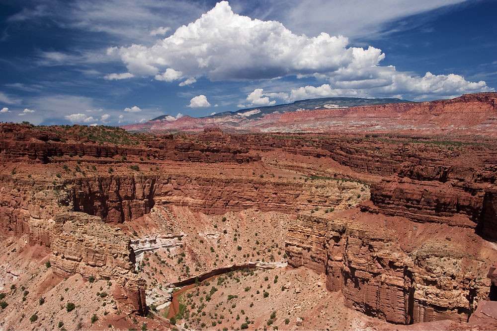
The Dynamic Landscape of Glacier Bay National Park and Preserve

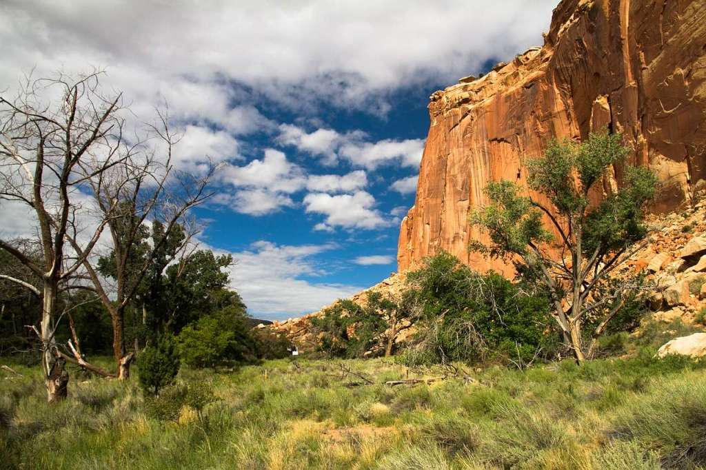
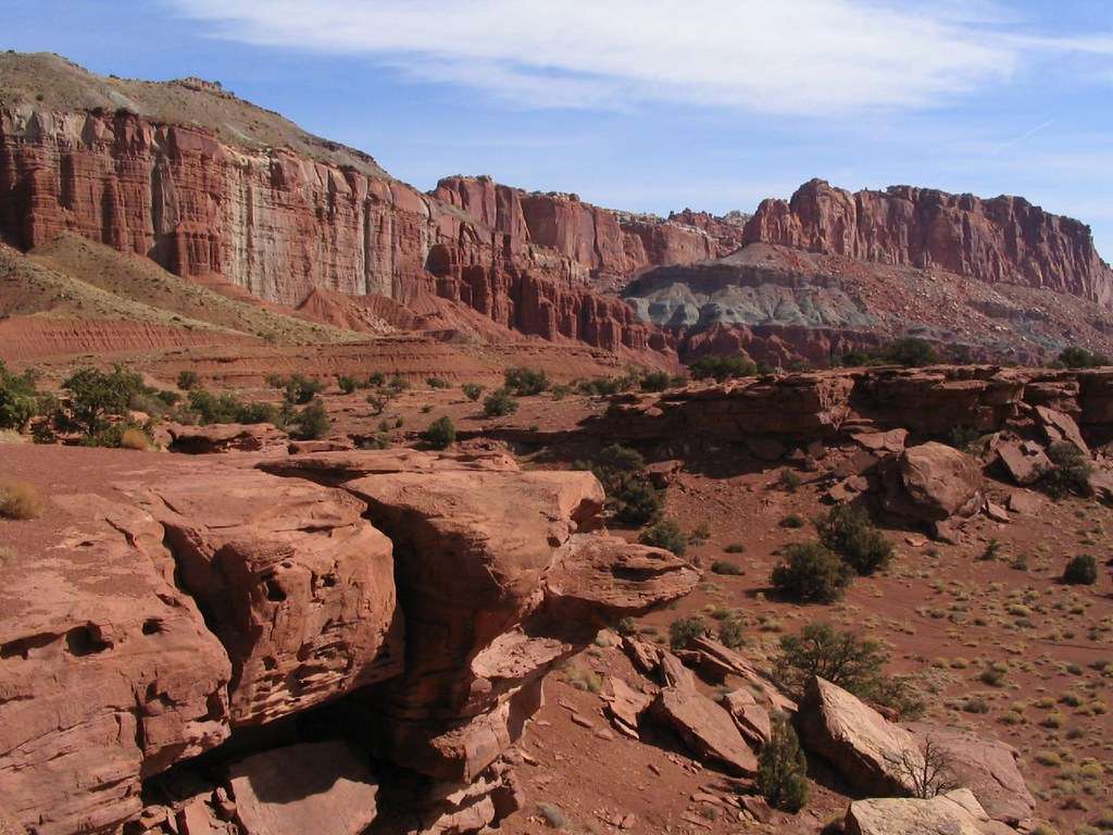
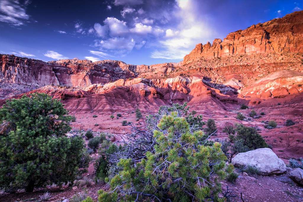
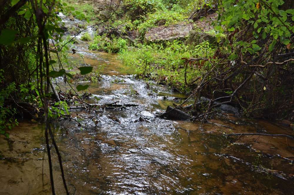
A testament to the transformative power of nature, Glacier Bay National Park and Preserve in southeastern Alaska is a living tableau of ever-changing landscapes. It showcases a dynamic geological spectacle characterized by a stunning panorama of ice-sculpted peaks and deep fjords. Here, colossal glaciers have carved the mountains and valleys over thousands of years, creating a vibrant and ever-evolving ecosystem that continues to fascinate scientists and tourists alike.

One of the park’s highlight features is its active tidewater glaciers, particularly the Margerie and Johns Hopkins Glaciers. Unique to Glacier Bay, these towering masses of ice extend from the mountains to the sea, periodically calving – a spectacular natural event where chunks of ice split off and crash into the bay with thunderous roars.

Flora and Fauna in a Unique Ecosystem

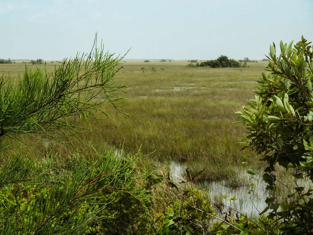
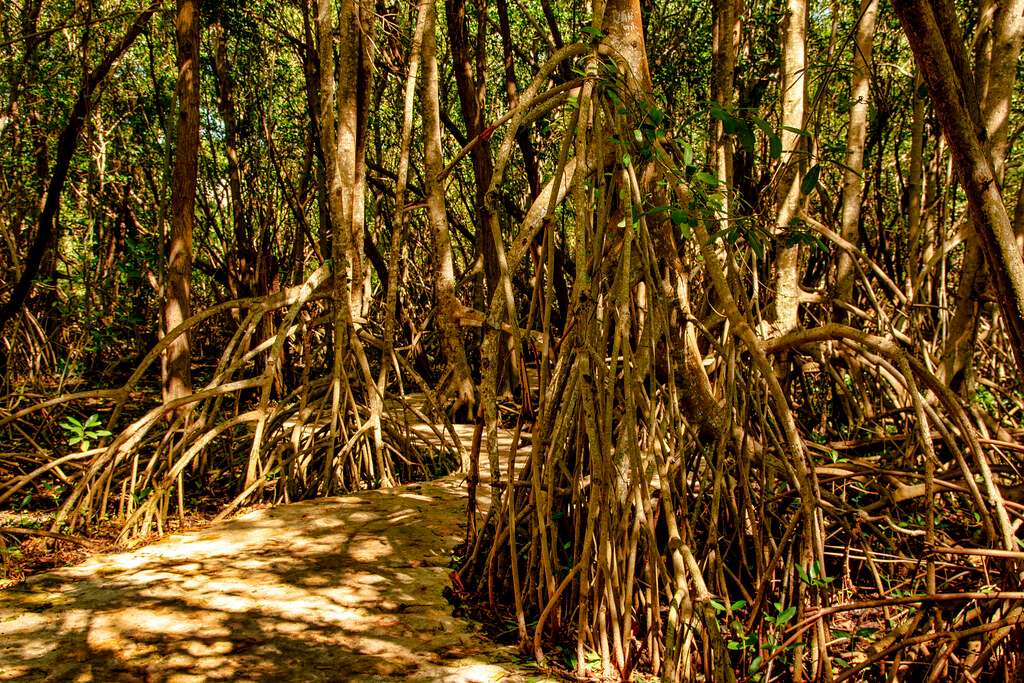
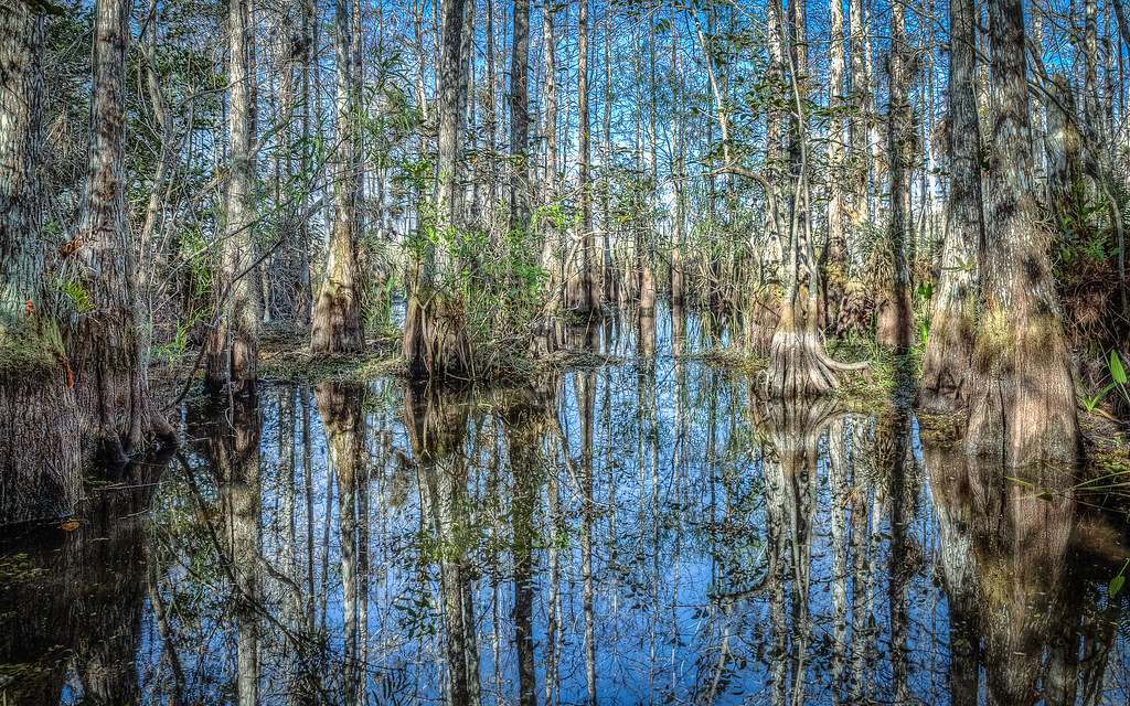
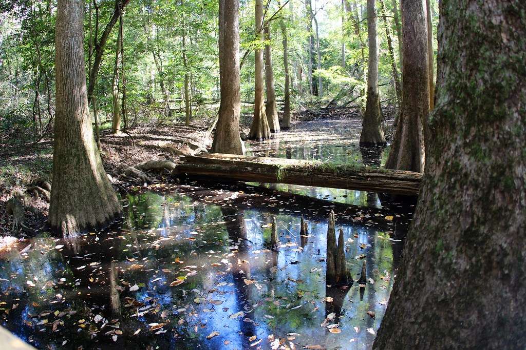
Equally captivating is the park’s abundant flora and fauna, essential components of its complex ecosystem. Plant life in Glacier Bay is rich and varied, teetering between resilience and fragility as the landscape shifts under the influence of glacial movement. Areas recently exposed by retreating ice serve as a canvas for nature’s grand experiment in succession, where pioneering species such as fireweed, willow, and alder are gradually replaced by Sitka spruce and western hemlock forests over hundreds of years.

Glacier Bay’s fauna, on the other hand, is a diverse collection of species finely tuned to the challenges of this extreme environment. Visitors to the park can spot coastal brown bears, mountain goats, and moose, as well as marine mammals like humpback whales, sea otters, and harbor seals. More than 280 species of birds, including the rare Kittlitz’s murrelet, also call this park home.

Despite the extreme conditions inherent in its environment, Glacier Bay National Park is teeming with life. Each dramatic shift in the glacier’s progression carries with it an opportunity for a new ecological era, giving life to an area once covered in ice. The park’s isolation and harsh conditions allow for a virtually untouched wilderness, providing a unique living laboratory for studying plant and animal adaptation and evolution.

The Attractions of Glacier Bay National Park and Preserve

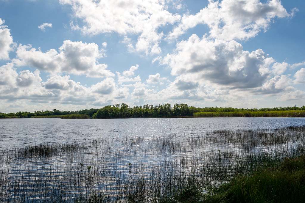
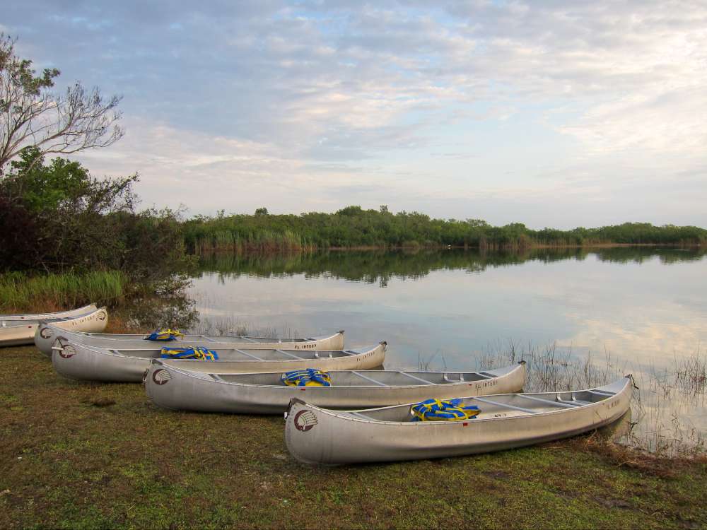
Glacier Bay National Park and Preserve boasts pristine waterways, dramatic landscapes, and a generous display of wildlife, each contributing to its overwhelming tourist appeal. With its unique and ever-changing weather patterns, the park records around half a million visitors annually. Tourists engage in diverse activities such as kayaking, camping, and glacier tours, while others savor the opportunity to experience the vibrant natural processes unfolding. The park also offers a glimpse into the rich cultural heritage of the Huna Tlingit people, demonstrated through its preserved archaeological sites.

For the sake of preserving its original allure and reducing any negative human impact, special regulations have been established, such as frequent closures around tidewater glaciers allowing seals to safely raise their pups. Through sustainable practices, Glacier Bay National Park and Preserve highlights how human enjoyment and understanding of these unique environments can still coincide with their enduring conservation.

A breathtaking view of Glacier Bay National Park and Preserve, showcasing ice-sculpted peaks, deep fjords, and a stunning glacier.

The Human History and Cultural Significance of Glacier Bay

The Tlingit People: Glacier Bay’s Earliest Occupants

Glacier Bay’s rich history can be traced back thousands of years to its earliest known inhabitants, the indigenous Tlingit people. For over 10,000 years, Tlingit tribes have made this region their home, thriving on a lifestyle primarily reliant on the sea’s bounty of hunting, fishing, and gathering opportunities. The Tlingit refer to Glacier Bay as “Sit’ Eeti Gheeyi,” or “the bay in place of the glacier,” reflective of the essential role the area has played in their culture and lifestyle.

Discovery by European Explorers

The initial sighting by European explorers was by George Vancouver in 1794. During his exploration, he noted a monumental wall of ice that was more than 20 miles in width and about 4,000 feet thick. He couldn’t go further into the bay due to the impenetrable ice. When explorers returned to the bay in 1879, led by naturalist John Muir, they were surprised to find that the glacier had retreated more than 30 miles up the bay, revealing new lands and deeper waters.

Scientific Research and Tourism Impact

In recent years, Glacier Bay has served as a significant field study location for scientists and researchers studying glaciology, marine ecosystems, and the impacts of climate change on these environments. The retreat of the glaciers has led to an influx of marine wildlife, making it a popular destination for tourists and wildlife enthusiasts. However, the increasing visitor populations pose their own challenges for managing environmental impacts.

Preservation Efforts and UNESCO World Heritage Status

Recognizing Glacier Bay’s ecological significance and natural beauty, the U.S. Congress designated it as a National Monument in 1925 and later as a National Park and Preserve in 1980. This measure was taken to protect its unique features and rich diversity of flora and fauna.

In 1979, Glacier Bay National Park, along with Wrangell-St. Elias National Park, Kluane National Park in Canada, and Tatshenshini-Alsek Park in British Columbia, were declared a combined World Heritage Site by UNESCO, recognized for their globally significant glacial processes and large intact ecosystems, such as the grizzly bear, wolf, moose, and Dall’s sheep populations.

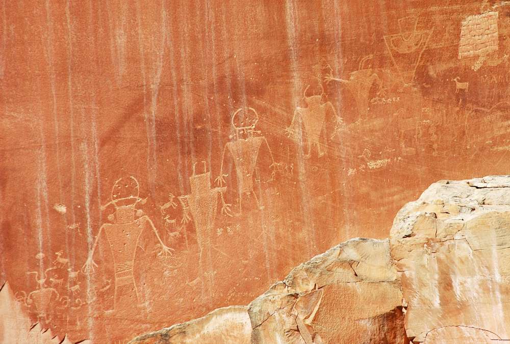
The Cultural Importance of Glacier Bay

The cultural and historical significance of Glacier Bay is as vast as its natural splendor. The Tlingit people, who view the bay as their ancestral home, imbue the area with profound cultural importance. Today, Glacier Bay remains a vibrant cultural landscape, with local indigenous communities continuing to nurture their strong bonds with the land.

Various initiatives to revitalize and interpret the history and culture of the Tlingit people in Glacier Bay are in progress. Through park programs such as Tlingit tribal house tours, ranger-led activities, and tribal demonstrations, visitors can delve into the wealth of the area’s cultural heritage. The goal of these interpretive activities is to illuminate the historical events, the intrinsic link of the native clan with the environment, and the essence of Tlingit culture for visitors.

A breathtaking view of Glacier Bay National Park showcasing towering glaciers and a tranquil bay surrounded by mountains.

Things to Do in Glacier Bay National Park and Preserve

Exploring the Splendors of Glacier Bay National Park

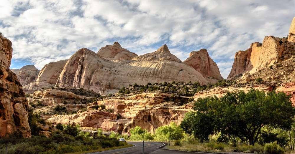
Glacier Bay National Park and Preserve in Alaska offers tourists and nature enthusiasts rich, diverse experiences in its sprawling 3.3 million acres. This breathtaking sanctuary, which has been designated a UNESCO World Heritage site, hosts a wealth of ecosystems, imposing glaciers, and a wealth of wildlife. It’s not just a haven for adventure and sightseeing; it’s also a platform for learning about unique geological phenomena amidst captivating landscapes.
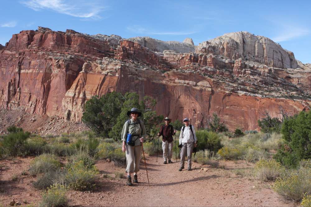
Hiking and Camping

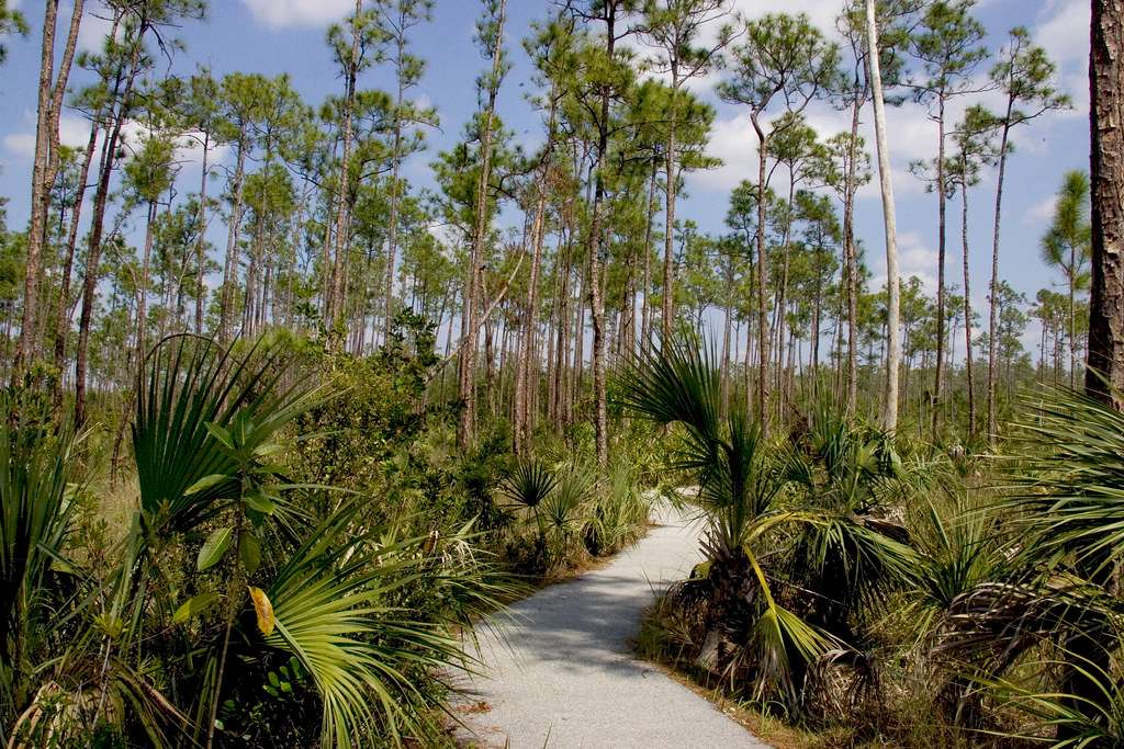
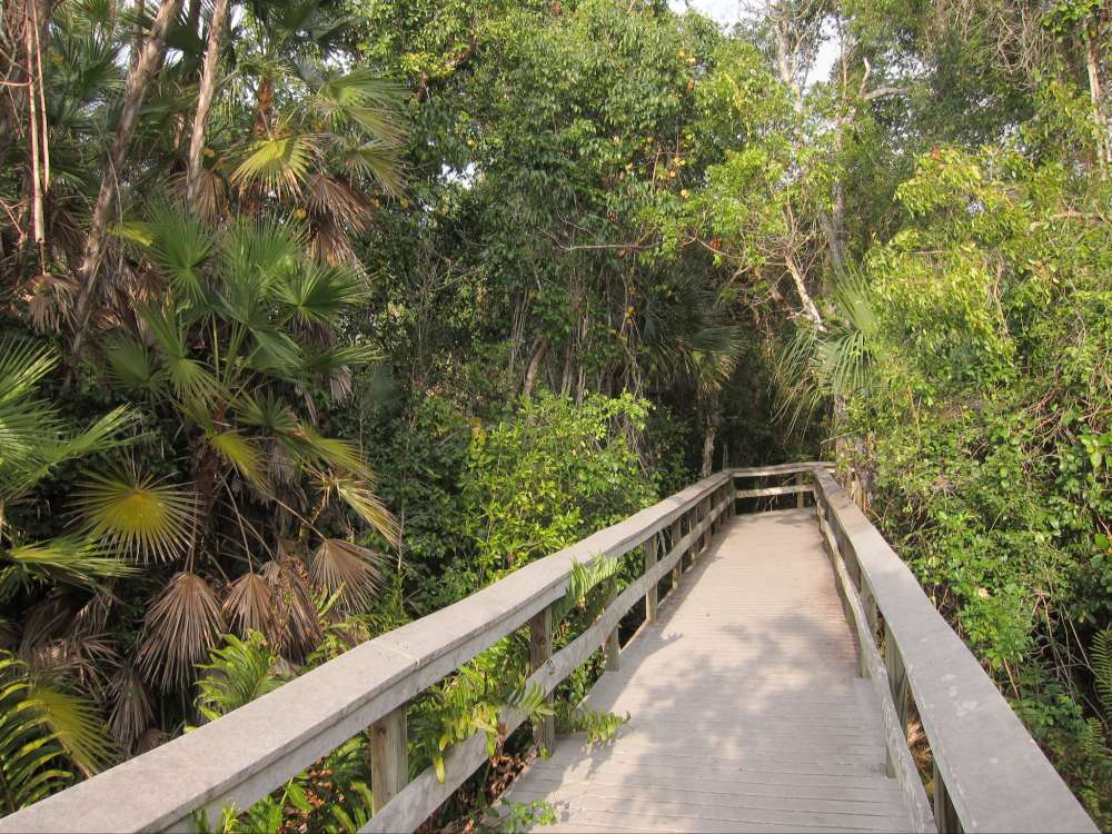
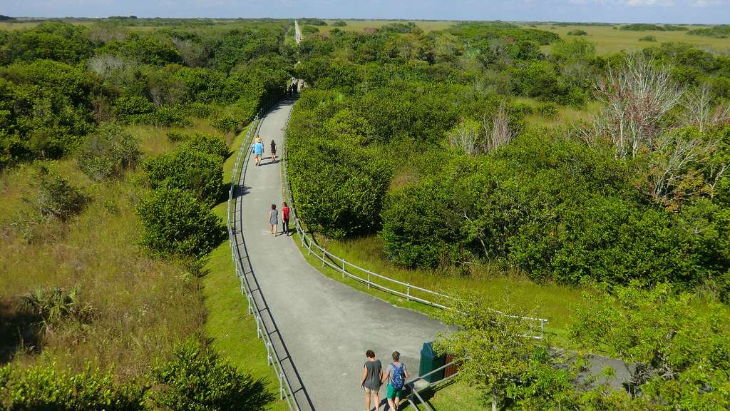
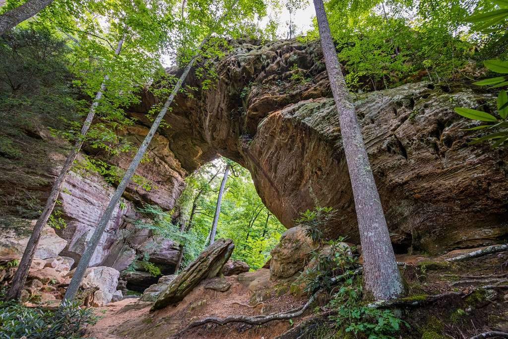
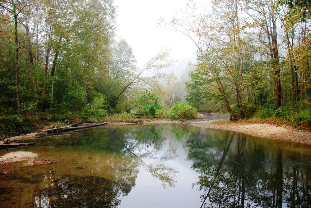
Among the vast wilderness of this national park, hiking trails of various difficulties offer the chance to observe towering mountain peaks, expansive glaciers, tranquil water bodies, and rich flora and fauna. The Bartlett River Trail, Beardslee Entrance Trail, and Bartlett Lake Trail are some of the popular tracks, each offering unique perspectives of the park’s landscape. There are no designated campgrounds within the park, but overnight camping is allowed with a free permit which can be obtained at the park’s visitor center.

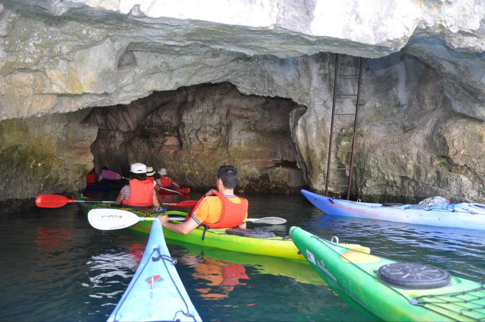
Kayaking and Boating

Kayaking or boating through the Glacier Bay waters provides a unique perspective of the park’s wonders, including the magnificent tidewater glaciers. Kayak rentals are available at Bartlett Cove and boating offers additional opportunities to view the park’s marine wildlife, such as seals, whales, and sea otters.

Wildlife Viewing

The park is home to a myriad of wildlife species including brown bears, moose, mountain goats, humpback and orca whales, sea otters, seals, and over 200 species of birds, making it a paradise for wildlife enthusiasts. Spot the elusive coastal wolves and wolverines or go bird watching for eagles, puffins, and the rare marbled murrelets.

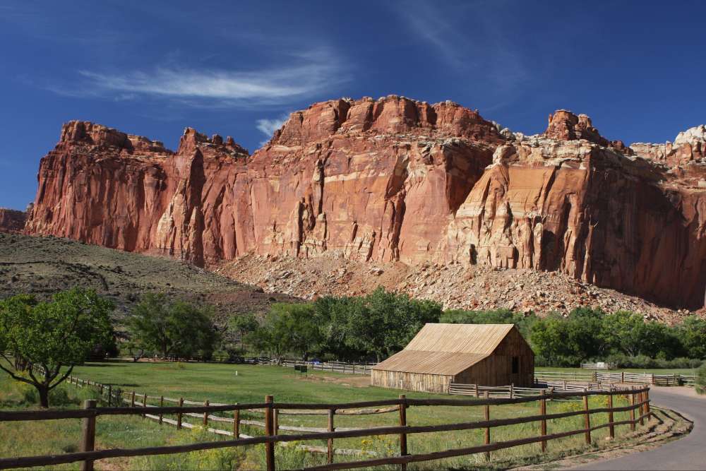
Visitor Services and Facilities

The park’s visitor services offer a range of amenities designed to optimize the visitor experience. The Glacier Bay Lodge is available for accommodation, featuring cozy rooms with rustic decor, and a full-service restaurant. The Bartlett Cove Campground offers primitive camping facilities. Additionally, the visitor center provides various interpretive programs and exhibits about the park’s natural and cultural history.

Weather Conditions and Safety Tips

The weather in Glacier Bay is unpredictable and changes rapidly. Visitors are recommended to dress in layers and bring waterproof clothing, even during the summer months. In the wilderness area, it’s important to maintain a safe distance from wildlife and to store food properly in order to prevent attracting bears. Visitors planning backcountry hikes or camping should make themselves aware of bear safety procedures.

Planning Your Visit

A visit to Glacier Bay National Park and Preserve is best planned during the months of June through August, when the weather is milder, and most of the park’s services and facilities are operational. It’s ideal to book accommodations well in advance, as Glacier Bay Lodge and other local lodgings can fill up quickly. While there are no entrance fees for the park, some activities may require permits. Always check park regulations and guidelines for the most up-to-date information on closures, restrictions, and safety information.

In conclusion

Glacier Bay National Park and Preserve stands as an incredible testament to nature’s raw power and magnificence, offering an unmatched experience for outdoor enthusiasts looking to delve into Alaska’s wilderness.

A breathtaking view of towering glaciers and tranquil water bodies in Glacier Bay National Park and Preserve.

With its awe-inspiring wilderness, exciting range of activities and notable historical and cultural significance, Glacier Bay National Park and Preserve truly stands as a treasure of natural and human history. It presents an incredible journey for both the casual observer and the adventurous explorer that’s brimming with invaluable experiences. Whether it’s peering up at towering glaciers, observing its rich ecosystem, deciphering the chapters of its past, or planning your unique adventure amidst its grandeur, this park is certain to leave you with lasting impressions. So, now that you’re equipped with the essential knowledge about this haven, let this be your call to explore, admire, and preserve the magnificent spectacle that is the Glacier Bay National Park and Preserve.

Discovering Cabins in Shenandoah National Park

Boasting sweeping vistas, rustic appeal, and an immersion in the rich tapestry of nature, Shenandoah National Park offers a plethora of cabin choices for those seeking refuge from the clamor of civilization. Amid these magnificent landscapes, you can choose from a bevy of cabin types, each boasting a unique blend of local craftsmanship and modern comforts. Nestled in some of the park’s most picturesque locales, these cabins tender not just shelter, but the spectacle of wilderness in the raw. Accommodation varies in terms of structure, size, and special features, each designed to deliver distinctive experiences for guests wanting to delve deeper into the beauty of Shenandoah while keeping the frills of domesticity within reach.

Types of Cabins in Shenandoah National Park

Shenandoah National Park’s Potomac Appalachian Trail Club (PATC) Cabins

Potomac Appalachian Trail Club (PATC) manages many cabins in the Shenandoah National Park. Ranging from rustic to fully-equipped, these cabins differ in their provisions. Some are very primitive, involving vault toilets and stream water sources, while others offer fireplace heating and spring water. You’ll find the cabins generally modest in size, most accommodating between 2-8 people, perfect for solo travellers, couples, or small families who want to expose themselves to the park’s natural beauty in its purest form.

Lodge-Style Accommodations: Skyland and Big Meadows Lodges

For people preferring a more traditional, less rustic experience, Shenandoah National Park offers lodge-style accommodations. Skyland and Big Meadows lodges are two of the park’s major lodging facilities. Skyland, at a magnificent elevation of 3,680 feet, not only offers breath-taking views but also cabin-style rooms, suites with a balcony or patio, and traditional rooms. Big Meadows Lodge is located closer to the heart of the park with access to three popular waterfalls. In addition to comfortable rooms, it offers multi-room suites and traditional cabins, all designed to offer guests the unique experience of staying within a national park while enjoying a certain level of comfort.

Lewis Mountain Cabins: The Historic Option

For those seeking a historical experience, the Lewis Mountain Cabins are a delightful option. As the smallest lodging facility in Shenandoah National Park, it offers a quaint, intimate setting. The Lewis Mountain Cabins were initially built in the 1930s as a segregated facility, but now serve all visitors. These historic cabins come equipped with heating, bed linens and basic kitchen equipment. Each cabin can host 2-4 people, an ideal getaway choice for couples or small families.

Shenandoah River Cabins: A Riverside Retreat

The Shenandoah River Cabins offer yet another unique experience. Located outside the park but within easy access, these cabins promise the tranquillity of riverside living. The cabins typically offer modern amenities including fully-equipped kitchens, WiFi access, hot tubs, barbecue facilities and outdoor fire pits. Sizes and styles vary, some built to comfortably accommodate larger groups, making them a stellar choice for larger families or gathering events.

Camping Cabins: Lewis Mountain and Loft Mountain

For visitors wanting to stay directly within the splendour of Shenandoah National Park, the camping cabins at Lewis Mountain and Loft Mountain are good considerations. While Lewis Mountain’s camping cabins come with some furnishings and electricity, Loft Mountain’s cabins are more primitive, offering a sheltered, campsite-like experience with no electricity.

The various accommodations at Shenandoah National Park, including a broad range of cabins, are strategically designed to cater to different visitor requirements and tastes. Whether you are interested in experiencing a taste of history, finding tranquility by the river, enjoying a rustic outdoor adventure or just looking for comfortable lodge-style living, there are numerous cabin offerings available to meet your unique needs.

Image of Shenandoah National Park cabins with beautiful natural surroundings

Location and Scenery of Shenandoah Cabins

The Scenic Beauty of Shenandoah Cabins

Tucked away in the serene Shenandoah National Park in Virginia, the park’s cabins offer a rustic retreat amidst the undulating Blue Ridge Mountains. They are scattered across various campgrounds within the park, including Matthews Arm, Big Meadows, and Loft Mountain. Each site offers a unique snapshot of the remarkable landscape and biodiversity of the park.

The majority of the cabins command sweeping views of the Shenandoah Valley and the Blue Ridge Mountains, presenting visitors with mesmerizing sunrises and sunsets. High, panoramic overlooks are characteristic of these cabins and many are within a short distance of favored viewing spots such as the Stony Man Overlook and Hazel Mountain Overlook.

Tenants at these cabins gain direct access to over 500 miles of diverse hiking trails catered to all abilities and age groups. These paths meander through thick forests, revealing majestic waterfalls, wildflower meadows, and secluded wilderness areas. The renowned Whiteoak Canyon trail, known for its six waterfalls, lies nearby, while the Appalachian Trail boasts a steeper challenge with panoramic mountain views.

Cabin dwellers can also enjoy the park’s rivers and streams, which offer fishing, swimming, and opportunities for quiet reflection. The Rapidan River and Hawksbill Creek are particular favorites, with the former known as a previous hideaway for President Hoover.

The abundant plant and animal species that reside around the cabins are a significant aspect of the experience. With over 200 bird species, 50 mammal species, and an array of insects and plants, the area offers plentiful opportunities for wildlife spotting and nature photography. Watch out for black bears, white-tailed deer, and various songbirds.

Besides the natural splendor, the Shenandoah cabins are conveniently close to historical sites that narrate the regional human history. These cabins are a mere drive away from President Hoover’s Rapidan Camp and remnants of old mountain communities that existed pre-park creation.

Spanning diverse wildlife to historical landmarks, cascading waterfalls to mountainous panoramas, the cabins in Shenandoah provide a unique opportunity for complete immersion in the tranquillity of Virginia’s Blue Ridge Mountains. No matter the specific location within Shenandoah National Park, all the cabins bear one commonality: a gateway to some of the most striking natural landscapes on the US east coast.

A photo of Shenandoah cabins nestled in the Blue Ridge Mountains, offering breathtaking scenic views.

Amenities and Services

Comfort and Convenience at Shenandoah Cabins

Cabins within Shenandoah National Park offer a wide array of facilities and services for a comfortable and enjoyable stay. While the specific amenities can vary slightly based on the cabin or cabin style, all of them generally offer a home-like comfort.

A majority of the cabins in the park come with fully equipped kitchen facilities, which typically include a refrigerator, stove, microwave, toaster, and coffee maker. Moreover, these kitchens are frequently supplied with basic utensils, cookware such as pots and pans, dishes, cutlery, and often, outdoor grills.

As for the bathroom facilities, most cabins have full bathrooms, equipped with a shower, sink, and toilet, along with amenities like towels, soap, and toilet paper. In some instances, cabins may also feature bathtubs or hot tubs, providing an extra touch of luxury to your stay.

The cabins are generally equipped with heating systems, making them suitable for year-round accommodations. These can be central heating, electric heaters, or traditional, cozy wood-burning fireplaces for the colder months.

The sleeping accommodations in the cabins range based on cabin’s size and type. Most cabins feature one or more bedrooms with comfortable beds, pillows, linens, and blankets. Larger cabins might offer additional sleeping arrangements like bunk beds or pull-out sofa beds.

Diverse amenities and services characterize the cabins in Shenandoah National Park. Some cabins boast features like decks with scenic views, fire pits for outdoor nighttime gatherings, or screened porches. While some cabins offer internet service and cable TV, others promise tranquility without such modern distractions.

The cabins at Shenandoah National Park manage to cover more than just the basics to ensure visitors experience a comfortable and memorable stay. They offer a home away from home in the heart of nature, enabling you to immerse yourself in the abundant beauty and tranquillity of the park.

A cozy cabin in Shenandoah National Park with a scenic view of the mountains and a fireplace inside.

Photo by kristinelliss on Unsplash

Booking Process and Prices

How to Secure Your Cabin at Shenandoah National Park

To secure your ideal cabin at Shenandoah National Park, you’ll need to access the park’s official website or a reliable third-party booking platform. Here, you can make direct reservations for cabins in any of the park’s lodges or campgrounds. Keep in mind, some websites may require you to create an account before you can book.

It’s common to book cabins as early as six months in advance. Simply select your preferred dates, pick the cabin type that suits your needs, and fill out the necessary details like guest count and payment information to complete the booking.

Ensure you read and fully comprehend the cabin’s specific booking policies before confirming. It’s usual for a deposit to be required at the time of booking, and keep in mind that changes or cancellations could incur fees.

Prices and Peak Times: Cabins in Shenandoah National Park

Price rates for cabins in Shenandoah National Park can vary greatly depending on the size, type, location, season, and the number of guests. However, the standard prices typically range anywhere from $125 to $300 per night. Visitors are encouraged to book early especially during the peak seasons to avoid missing out on their preferred choices.

The peak visiting times for Shenandoah National Park are during the spring and fall seasons. Particularly, the vibrant changing foliage in fall draws high visitor volume, making it one of the busiest times of the year.

Discounts and Special Packages

On occasion, the Shenandoah National Park extends a variety of exciting special packages and attractive discounts. These promotions may encompass bundled packages combining accommodation and activities, preferential mid-week rates, or special offers during off-peak periods. To stay updated on these promotions, you can sign up for newsletters from the park’s official website or contact the park directly.

Moreover, seniors, active military personnel, and disabled individuals are eligible for additional discounts. To illustrate, the ‘America the Beautiful’ series of passes grant these specific groups free or discounted entry to federal lands.

One key tip for securing your desired cabin at the optimum cost is to book early. Additionally, it’s reassuring to know that all revenue from cabin reservations directly contribute to the upkeep and sustainability of the Shenandoah National Park.

Image of cozy cabins surrounded by lush nature in Shenandoah National Park

Experiences and Reviews

First-Hand Experiences: Cabins in Shenandoah National Park

The cabins of Shenandoah National Park have drawn admiration and recognition from numerous guests for their idyllic locations and their peaceful atmosphere. These cabins, enveloped in lush trees and diverse landscapes, are highly appreciated for their authentic woodland living encounter. Guests often rave about the delightful patios and cozy furniture, labeling them as the ideal spots for enjoying morning coffee amidst beautiful sunrise views or sipping on evening beverages under a twinkling starry sky.

Activities Available: More than Just a Stay

Staying in these cabins is not merely about accommodation; it goes well beyond that. Shenandoah National Park is renowned for its sweeping mountain vistas, cascading waterfalls, and the vast network of trails embracing flora and fauna. Guests have frequently mentioned their satisfying walks alongside Skyline Drive, and the rewarding hikes to witness the majesty of Shenandoah’s waterfalls. A lot of reviews also touched upon their ventures to the Luray Caverns, a striking natural treasure situated close to the park.

The park also provides opportunities for adventurous guests to engage in bird watching, wildlife spotting, and even horseback riding. Fishing enthusiasts have shared their fond experiences of peaceful hours spent at numerous streams in the park.

Comfortable Stay: Know Before You Go

Several testimonials point out the importance of being well-equipped for the ideal Shenandoah cabin experience. The cabins themselves come furnished with the basic amenities like bed linens, towels, and kitchen essentials. However, guests are encouraged to carry their necessities like toiletries, food, drinkable water, and specific cooking utensils based on their needs.

In the cooler months, since the cabins are not equipped with electrical outlets, reviewers suggested bringing warm clothing, blankets, and firewood for the wood-burning stoves present in the cabins. Also, packing a first-aid kit, bug spray, and flashlights were advised by past visitors, especially for those planning to explore the backcountry trails.

Lastly, connectivity can be limited in this natural haven. While some were delighted with the break from the digital world, others recommended preparing with offline maps and entertainment.

Overall, Shenandoah National Park cabin stays were rated as an exceptional experience by most visitors. The cabins, coupled with the spectacular views and opportunity for exploration, make it a favorite for both relaxation seekers and adventure enthusiasts.

A serene image of cozy cabins surrounded by trees in Shenandoah National Park.

While the majestic beauty of Shenandoah National Park draws thousands of visitors every year, it’s truly the immersive cabin stays that solidify visitors’ impressions of this extraordinary wonderland. From petite, intimate cabins suitable for romantic getaways, to larger structures made for groups and family spend, Shenandoah cabins have a range of amenities, comfort options, and awe-inspiring views to cater to a varied palette of preference. These robust offerings, coupled with insightful user reviews, are a clear testament to the unforgettable experiences waiting for you in Shenandoah. Regardless of the cabin you choose or the time of year you visit, you can rest assured that a heart-warming rendezvous with Mother Nature is part and parcel of your Shenandoah sojourn.

Uncover the Wonders of Rocky Mountain National Park Hiking

Awash with majestic scenic views, a diverse array of flora and fauna, and steeped in rich history, Rocky Mountain National Park invites outdoor enthusiasts and casual day trippers alike to its vast, unspoiled wilderness. Our comprehensive guide delves into all the critical aspects of exploring this iconic destination, from its top-rated trails to essential tips for safe and enjoyable hiking experiences. We will also unravel the park’s seasonal transformations and shed light on its fascinating history and cultural legacy. By equipping yourself with this knowledge, your journey through the dramatic landscapes of Rocky Mountain National Park can become not just a thrilling adventure, but also an educational odyssey.

Best Hiking Trails in Rocky Mountain National Park

Emerald Lake Trail

Located near Estes Park, the Emerald Lake Trail offers stunning views and landscapes with a relatively easy climb. The out and back trail is 3.2 miles in total with an elevation gain of 708 feet. The trail takes you through Dream Lake and Nymph Lake before culminating at Emerald Lake. Highlights include looking out over the glaciers and distinct wildlife like elk and marmots.

Longs Peak Trail

Longs Peak Trail is not for the faint-hearted but is considered one of the best hikes in Rocky Mountain National Park. It’s a strenuous trail stretching over 14.5 miles with an elevation gain of more than 5000 feet. This trail is not recommended for beginners. You will be required to scramble over rocky terrains and cross boulder fields. The main appeal, however, is the panoramic view from the summit, extending into Wyoming, Kansas and New Mexico.

Mills Lake Trail

The Mills Lake Trail is a moderately difficult 5.3-mile trail with an elevation gain of 700 feet. It’s known for the stunning view of the snow-dusted Half Mountain across a crystal-clear lake. The trail goes past Alberta Falls, one of the park’s most popular spots, making an excellent option for a picnic.

Sky Pond Trail

Defying its moderate difficulty level, the Sky Pond Trail presents some of the most breathtaking views in the park. The 8.1-mile trail leads you past Alberta Falls, the Loch, Glass Lake, and finally, Sky Pond. A portion of the trail requires some steep climbing and scrambling over slick rocks, so good hiking boots are a must.

Bear Lake Trail

A looped trail around the named lake, the Bear Lake Trail, is perfect for beginners or those looking for a less strenuous hike. The 0.7-mile loop has negligible elevation gain and is wheelchair accessible. There are several trailheads from here leading to other lakes and peaks if you wish to extend the hike.

Planning Your Mountain Hike

Before setting off on your trail adventure in the Rocky Mountain National Park, it’s important to keep in mind the park’s changing weather patterns. It’s crucial to gear up in suitable clothing for comfort and safety and don’t forget to hydrate! The dry mountain air can quickly dehydrate you, so carry enough water. Remember, specific areas in the park prohibit both camping and fires, so plan your route according to the rules laid out.

The park uses a timed-entry reservation system to manage crowding during peak visitation hours. To secure your spot, it’s best to book in advance. Keep in mind the “Leave No Trace” principle while enjoying the park’s beauty – ensure you carry out anything you carry in to maintain the park’s natural aesthetics for future visitors.

Scenic views of various trails in Rocky Mountain National Park

Safety and Preparation for Hiking in the Rocky Mountain National Park

Essential Documents and First Aid Necessities

Being fully prepared for your hiking trip in the Rocky Mountain National Park means having the correct documentation at all times. This includes relevant permits – crucial for overnight camping, and trail maps to guide you. Always have your identification on you, and it can be handy to have the park rangers’ emergency contact numbers saved.

Moreover, a fully stocked First Aid Kit is a hiking necessity. Items to include range from antiseptic wipes, adhesive bandages of several sizes, blister plasters, butterfly bandages, gauze pads, to a small roll of medical tape, tweezers, and safety pins. Include pain relievers and remember to bring your personal medications if necessary. Before you embark, ensure you notify someone of your hiking plans and your anticipated return time for safety.

Attire and Food

Dress strategically in layered clothing as weather in the Rockies can be unpredictable. Always have a waterproof layer to protect from potential rain, and bring warm clothing because temperatures can drop significantly. High-quality hiking shoes, ideally waterproof, provide traction and prevent injury.

Food and water are essential. Carry enough for the entire hike, plus a little extra. Consider packing high-energy foods such as nuts and energy bars. Always carry purification tablets or a water filter in case you need to refill from a natural water source.

Safety Measures and Tools

Follow marked trails to avoid getting lost. Have a compass and a map as a backup to your GPS device. A whistle is useful for alerting others in case of emergency.

Headlamps or flashlights with extra batteries are necessary for hiking during dawn, dusk, or night. Always prioritize safety over hiking speed or distance covered.

Emergency Procedures

Always have a clear plan of action in case of emergencies. In case of severe injury or illness, call 911 immediately. If you are lost, call the local park rangers or use a whistle to signal for help.

Knowing basic emergency survival techniques, such as how to build a fire or create a shelter, can be invaluable in extreme situations. Familiarize yourself with basic first aid procedures for common hiking injuries.

Wildlife Encounters

The Rocky Mountain National Park is home to a variety of wildlife. Bears, moose, and other large animals can pose a real threat. Carry bear spray and know how to use it. Avoid approaching or startling wildlife and keep a respectful distance. Educate yourself about the steps to take if you encounter a wildlife species.

Weather Considerations for Hiking

When planning your hike through the Rocky Mountains, it’s crucial to consider the rapid shifts in weather that can occur. It’s not uncommon for blue skies to swiftly give way to a snowstorm. Thus, checking the weather forecast before embarking on your hike is essential. Prepare yourself for the challenges that chilly temperatures and higher elevations can pose, including the risk of hypothermia and altitude sickness. In order to acclimate appropriately, take periodic breaks as needed.

A beautiful view of Rocky Mountain National Park, with snow-capped peaks and lush green forests.

Flora and Fauna of Rocky Mountain National Park

Nature’s Bounty in Rocky Mountain National Park

As you hike through Rocky Mountain National Park, you’d be captivated not only by the awe-inspiring landscapes but also its rich biodiversity. The Park showcases a host of natural wonders including over 1,000 different plant varieties and 280 distinctive bird species. Additionally, you might even catch a glimpse of some larger mammals, such as elk, moose, and black bears that call this Park home.

Distinct Vegetation Zones

The Park’s flora can be segmented into five distinct zones: montane, subalpine, alpine, riparian, and wetland. The montane zone, occurring at lower elevations, is characterized by ponderosa pine forests and meadows filled with wildflowers in the summer. The subalpine zone is dominated by lodgepole pine forests and spruce-fir forests. The treeline signifies the start of the alpine zone, where the harsh climate allows for only the hardiest of plants, such as the alpine sunflower. Riparian and wetland zones are shaped by the presence of water and are excellent habitats for a diverse range of plant species.

Wildlife Encounters

If you’re lucky, a hiking excursion in the Park could allow you to spot some of its resident wildlife. Apart from the large mammals mentioned above, mule deer, coyotes, bighorn sheep, and even elusive creatures like mountain lions, bobcats, and lynxes also inhabit the Park.

Birdwatchers will particularly enjoy Rocky Mountain National Park as it is a nesting ground for a variety of bird species including the White-tailed Ptarmigan, the Western Tanager, and the Mountain Bluebird.

Aquatically-inclined wildlife such as Greenback Cutthroat Trout can be spotted in the park’s lakes and well-preserved stream habitats.

Hikers should be aware and respectful of wildlife and should never feed or attempt to touch any wild animal.

Ecological Significance

The Park sits within the Southern Rocky Mountain Biosphere Reserve, signaling its global ecological significance. This designation stresses the outstanding biodiversity that gives the Park its aesthetic and ecological-rich value and emboldens efforts to maintain and preserve this area.

Conservation Programs

The National Park Service has in place several conservation programs aimed at the protection and preservation of this precious ecosystem. These initiatives involve species monitoring, environmental education programs, wildlife management, and restoration projects.

For example, the Elk and Vegetation Management Plan involves monitoring elk populations and the impact of their grazing on the ecology. Other key programs include efforts to restore the natural fire regime, invasive species control, and preservation of the native Greenback Cutthroat Trout.

Embarking on a hike through Rocky Mountain National Park is a spellbinding journey filled with diverse wildlife and breathtaking scenery. As we traverse this awe-inspiring landscape, it’s vital that we take on the role of conscientious explorers, striving to appreciate and preserve these natural marvels for future generations.

A breathtaking view of Rocky Mountain National Park, showcasing its stunning landscapes and diverse wildlife.

Seasonal Considerations for Hiking in Rocky Mountain National Park

Seasonal Aspects Impacting Your Rocky Mountain Adventures

Before you lace up your hiking boots and hit the trails of Rocky Mountain National Park, take a moment to consider the time of year. The shifting of the seasons brings significant changes to the trails, wildlife behavior, weather conditions, and visibility. These changes can have a profound impact on your hiking experience.

Spring: Thawing Out and Beckoning Wildlife

The arrival of Spring, from March through May, brings a period of change to Rocky Mountain National Park. Day-to-day temperatures can swing wildly, making layered clothing a smart investment for sudden chills. Higher trails may still be blanketed in snow and ice until late May or early June, necessitating the use of crampons or microspikes as a safety precaution. With many animals emerging from their winter slumber, wildlife activity increases; ensure you maintain a safe distance, particularly from juvenile animals and their mothers.

Summer: Peak Hiking but Watch the Skies

The summer months, June through August, are the peak of the hiking season. The park is fully accessible, and a rainbow of wildflowers carpets the mountain and meadow landscapes. However, this is also the busiest season. Early morning hikes are recommended to avoid crowds and find parking. With near-daily afternoon thunderstorms, aim to be off high-altitude trails before noon to avoid lightning risk. Also, observe fire safety rules as forest fires are a potential hazard in these dry months.

Autumn: Fall Foliage and Elks Rutting Season

Traditionally taking place from September to November, autumn brings cooler temperatures and stunning fall colors which make for amazing photogenic trails. It also marks the elk rutting season, a spectacle that draws numerous wildlife enthusiasts. Take note, trail closures may be implemented due to increased wildlife activity. Remember to pack warm clothing as temperatures can drop significantly during the nights.

Winter: Snowy Trails and Solitude

From December to February, winter transforms Rocky Mountain National Park into a snowy wonderland. Many higher elevation trails may be closed due to snow, but lower elevation trails are open to hikers and snowshoers. Be ready for dramatic temperature changes and pack accordingly with adequate insulation layers and gear. Winter hiking offers a surreal and peaceful experience and is perfect for those seeking solitude.

As an adventurer planning to hike in the Rocky Mountain National Park, it is important to respect the park’s natural beauty and stay on marked trails for safety. Familiarizing yourself with the Leave No Trace principles is vital and applying them throughout your hike can truly preserve the pristine environment of the park. Regularly updating yourself on weather forecasts and trail conditions will enable you to enjoy a safe and memorable hiking experience.

Image depicting the changing seasons in Rocky Mountain National Park.

History and Cultural Significance of Rocky Mountain National Park

The Historical Legacy of Native American Tribes in Rocky Mountain National Park

Rocky Mountain National Park’s rich cultural heritage is deeply rooted in the history of Native American tribes like the Arapaho, Cheyenne, Ute, among others. These tribes have had a connection with the area for over 11,000 years, such a deep connection that their ancestral footprints are embedded within the myriad of archaeological sites scattered throughout the park. Sites such as Game Drive tell tales of their hunting techniques used on large mammals during the late prehistoric period, serving as a prominent reminder of their historic presence.

Establishment of Rocky Mountain National Park

Many American settlers and explorers flooded into what is now Rocky Mountain National Park in the 19th century, especially after the 1859 Colorado Gold Rush. However, it wasn’t until 1915 that American industrialist John D. Rockefeller financed the establishment of the National Parks Conservation Association, leading to President Woodrow Wilson signing the Rocky Mountain National Park into law. This act brought the park into the National Park System, which aimed to conserve and protect unique environments for future generations.

Development of Rocky Mountain National Park

The development of the park as a recreational area took shape in the 1930s under President Franklin D. Roosevelt’s New Deal programs. The Civilian Conservation Corps (CCC) established camps in the area and worked on infrastructure projects such as trail construction and maintenance, bridge and building construction, and erosion control. The CCC’s efforts are still visible in the park today, particularly in relation to some of its major hiking trails.

Hiking in Rocky Mountain National Park

The park now boasts over 359 miles of hiking trails offering outdoor enthusiasts a chance to explore the stunning beauty of the Rockies. These trails range from flat and relaxing walks around crystal clear lakes to adventurous hikes to summit peaks over 12,000 feet high. Each trail provides unmatched opportunities to witness wildlife in their natural habitat and enjoy the breathtaking scenic beauty the park offers.

Rocky Mountain National Park’s Contributions to Outdoor Recreation and Conservation

Rocky Mountain National Park has contributed enormously to the culture of outdoor recreation. The park not only provides a vast wilderness for adventurers to explore but also fosters environmental consciousness and respect for nature’s raw beauty. It has become a provider of an array of eco-friendly activities, including hiking, nature photography, bird watching, and camping, drawing visitors from all over the world each year.

Moreover, the park plays a crucial role in conservation. It’s home to hundreds of species of flora and fauna, some of which are endangered. The park’s management takes such a preservation-friendly approach to encourage regrowth and repopulation of these species.

Indigenous Cultural Education in Rocky Mountain National Park

Today, the park makes efforts to educate visitors about the park’s rich indigenous heritage. Visitors can learn about these indigenous communities through educational programs offered by the park, including guided hikes focusing on historical and cultural awareness. Efforts to share and preserve the history and culture of the Native American tribes associated with the Rocky Mountain National Park help visitors gain a deeper understanding and appreciation of the park’s significance.

Embracing the magic of Rocky Mountain National Park means more than simply setting foot on its trails; it’s about understanding the intricate ecosystem, respecting the wildlife inhabitants, and embracing the cultural and historical essence of this cherished place. As the seasons shift, so do the opportunities for discovery and adventure in the park, bringing ever-changing backdrops and experiences. With careful preparation and mindful consideration of our advice, the serenity, beauty, and awe-inspiring grandeur of the Rockies can be enjoyed in their fullest expression. As you venture into the wild heart of the park, carry with you the spirit of exploration and reverence that has defined this national treasure for generations.

Yorba Linda Regional Park: A Nature Lover’s Paradise

The Yorba Linda Regional Park is reminiscent of Thoreau’s Walden Pond.

At the center of the park is a small lake, with babbling brooks feeding it.

Discovering Yorba Linda Regional Park: A Walden Pond Experience

Its shores are covered by myriad trees, ducks swim across the pond, crows and storks find food, and squirrels chew on acorns.

While the natural environment is rugged, the park is tamed by infrastructure.

I arrive at the park feeling energized by the illustrious setting and all that it has to offer.

I begin to wonder how deeply I can get inside this landscape.

Yorba Linda Regional Park path

Park Amenities: Balancing Nature and Modern Comforts

Quickly I begin to realize that this natural landscape has been enhanced by several human-made amenities.

While I am not excited about the unnatural elements of the park, I do see their value.

There are multiple playgrounds for children, a baseball field, and enough picnic tables in the shade for everyone.

I pull up my car and see a couple playing with their small child.

Barbecues dot the park, where people can bring charcoal to grill meats.

I don’t see anyone using them, and I think that’s a shame.

It’s a beautiful day and there should be people enjoying it.

But, after all, it’s a weekday and most people are at work.

Yorba Linda Regional Park playground

I walk towards the lake, which shimmers with luster.

I see a turtle poke its head out of the water.

On the surface of the water, I see the silhouette of a large bird.

I do a double take.

Apparently, you can take a small swan-shaped boat onto the lake.

Kids are slowly navigating the calm waters, laughing, and enjoying themselves.

Yorba Linda Regional Park lake with swan-shaped boat

Embracing Family Fun: Activities for Children and Adults Alike

It’s good for children because they can wear life vests and be watched by their parents on the shore.  

Though there are plenty of bathrooms, there are more being built.

You can also rent a four-person bike or small buggy that looks like it’s more suited for the desert.

The activities at the park appear to be multiplying.

There is no shortage of things for children and adults to do.

Yorba Linda Regional Park buggy

There other activities found at the Yorba Linda Regional Park include recreational sports.

You can go fishing, but we are careful you might catch a turtle by accident.

I pass by a fisherman who nods at me.

He recognizes the lone man at the park enjoying himself.

Yorba Linda Regional Park lake

Exploring the Outdoors: Recreational Sports and Scenic Trails

The trails that traverse the park to go through the large area surrounding it and beyond.

The trails connect to other routes and trails outside of the park, going through neighborhoods and other wilderness areas.

I don’t know for sure how far these trails go, or if they circle back to the park.

I don’t have enough time to find out.

Sitting by the lake on one of the many benches, I take in the atmosphere of the setting.

Yorba Linda Regional Park bridge

A Pet-Friendly Park: Welcoming Your Furry Friends

I see a few people walking their dogs.

Despite the many wild animals around, this is a pet-friendly space.

It’s a great spot to bring the whole family.

Yorba Linda Regional Park tables

With your spouse, kids, and dog, the park can provide all kinds of great ways to spend your time together.

Between the ability to picnic, barbecue, fish, take a walk, rent a bike, and more, there’s no surprise that this area is popular for all kinds of different people.

Yorba Linda Regional Park wild life

Connecting with Nature: Yorba Linda Regional Park’s Diverse Community

Families and couples from all walks of life are found here.

Single people run or walk their dogs. Older people stroll slowly. Kids run recklessly.

Even on a Thursday afternoon, the park is littered with people having a nice time.

It is vibrant and welcoming.

There is a car entrance fee, but on the weekdays, it is only three dollars.

With many trash cans to dispose of your waste, the park is clean and well taken care of.

Whether you are a hippy or a businessperson, the park is for you.

When you spend some time in this area, you can feel the natural world around you despite the structure that the government has provided.

Yorba Linda Regional Park stream

Finding Serenity: Mindfulness and Meditation in the Park

I sit on a bench near the lake and close my eyes.

I do some meditating.

I hear the birds chirp in the trees and children cooing in the distance.

I breathe in the fresh air and focus on the rhythm of my breathing. I don’t know how long I spend on my mindfulness training because time itself begins to fade away.

Whether you can stay for hours or just a few minutes in this area, the Yorba Linda Regional Park is a great place to get away from it all.

It is perfect for introspection, soul searching, or reading a book.

It is a great place to spend time with your family and loved ones. This space is dynamic and just plain lovely.

Yorba Linda Regional Park lake

Planning Your Visit: Accessibility and Parking at Yorba Linda Regional Park

With plenty of parking, you will never have to worry about driving around to find a spot.

There is no stress involved with coming to the Yorba Linda Regional Park.

Whether you are bringing the family or just your thoughts, this area is magically beautiful and serene.

Even with children playing loudly in the distance, peace is easy to find.

Yorba Linda Regional Park parking lot

Southern California’s Hidden Gem: The Unparalleled Beauty of Yorba Linda Regional Park

When it comes to parks in Southern California, Yorba Linda Regional Park is one of the best.

Yet, there’s much more to explore!

Discover a variety of outdoor gems in our guide to the 15 Best Parks in Anaheim (Ranked Best to Worst).

There’s a perfect park waiting for everyone.

It is extremely pleasant and exceedingly beautiful. On a nice day, the sun shines upon the water triumphantly.

The birds chirp from the trees and ducks glide across the lake.

Married couples walk along the trails with their families.

Single men and women bring their dogs for a walk, go for a run, or just come to collect their thoughts.

Children laugh and play on a slide, a jungle gym, or the baseball field.

Ride a bike or take a boat onto the water.

There is no better place to spend a Sunday afternoon.

Yorba Linda Regional Park lake with swan-shaped boat

Making Memories at Yorba Linda Regional Park: A Must-Visit Destination for All

Next time you are in the area, make a trip to the Yorba Linda Regional Park.

Bring a picnic basket, some food and drinks, your dog, children, and significant others.

Gaze out onto the water and take in the peace and serenity the landscape has to offer.

Combining the natural environment of the lake and all the extras that the city has enhanced it with, the Yorba Linda Regional Park is a great place to relax and enjoy life.

Whatever you choose to do here, you will have a nice time.

Yorba Linda Regional Park lake with swan-shaped boats

What Is The Best Time To Visit Capitol Reef National Park?

Capitol Reef is a lesser-known natural marvel in Utah. This does not, however, make it any less magnificent than the other four of the powerful five national parks. The optimum time to visit Capitol Reef National Park is a hotly debated issue. In this beautiful park, we think that each season may provide incredible adventure! So, without further ado, let’s have a look at the various delights that await visitors to Capitol Reef National Park at different times of year.

Visiting Capitol Reef National Park in Spring

Capitol Reef’s spring will most likely be considerably colder than you think.

While the landscape blossoms, temperatures typically vary from the upper 60s to the low 10s.

Mild rainstorms are also likely to occur during the trip.

However, because Capitol Reef is a dry desert area, any prolonged showers are unlikely to catch you off guard.

Short days with long periods of sunshine will be ideal for a variety of activities, including hiking and riding.

In the following months, the Fruita Orchards will bloom, providing magnificent views and fragrances to enjoy while exploring.

During the spring season, crowds will be lighter, allowing for more solo exploration of the trails and valleys.

Visiting Capitol Reef National Park in Spring

Read: Is Traveling A Hobby? The Ultimate Guide To An Exciting Way Of Life

Learn about Reasons why traveling is A hobby

Visiting Capitol Reef National Park in summer

Summer at Capitol Reef is not as hot as it is in many other parks in the Southwest.

On paths with no shade, temperatures will seldom surpass 100 degrees Fahrenheit.

Many trails include shaded sections in the event of a heat wave, and trips may be planned properly using Parkside information.

During the later summer months, travelers should exercise caution because flash flood season will be in full swing.

While flash flooding is uncommon, explorers should be prepared in the event that it does happen and know how to protect themselves and their loved ones safe.

Before you leave the park, pay a visit to the Gifford House Store and Museum, which has longer hours throughout the summer!

Visiting Capitol Reef National Park in summer

Read: 21 Fun Facts About Capitol Reef National Park You Should Know

Learn about Capitol Reef National Park has a variety of lodging options

Visiting Capitol Reef National Park in fall

Capitol Reef’s hiking and bike paths will become more active in the autumn as the park begins to chill in preparation for winter.

During the fall, there are plenty of peaches, plums, and pears to be had since the harvest is just around the corner!

Exploring the fruit tree orchards creates a very lovely scenario that some may consider unique in a high desert setting.

Because the park is less crowded when the weather cools in the late autumn, this is the perfect time to come if you don’t like crowds.

The Park will be comfortable warm throughout the day, suitable for trekking and camping.

Temperatures drop to a bearable cold as the sun sets, hovering in the mid-40s to low 50s.

Bring a warm sleeping bag and insulated tents if you plan on camping in this national park as part of your journey. When it’s time to go to bed, that cold might be a pain!

Visiting Capitol Reef National Park in fall

Visiting Capitol Reef National Park in winter

Capitol Reef National Park is unusually quiet in the winter, with the park practically vacant during the coldest months of the year.

This wonderful setting is the private snowy playground you always desired as a child, with mild snowfall and stunning sandstone spires!

Temperatures seldom fall below freezing and are usually about 10-15 degrees Fahrenheit.

Backcountry skiing, snowshoeing, and even the occasional offroading trip are all possibilities when it snows.

Overall, if you’re looking for a calm beautiful retreat with lots of thrills, winter is the best time to visit Capitol Reef!

Visiting Capitol Reef National Park in winter

What is the best time to visit the Capitol Reef National Park?

Any time of year is ideal for a visit to Capitol Reef! The changing seasons offer diverse landscapes, activities, and isolation possibilities.

Some think spring is the finest, summer may be scorching but also quite pleasant, and winter, while freezing, is certainly lovely.

You’ll be able to see Capitol Reef at any time of year, and you’ll be in awe of its magnificent beauty!

What is the best time to visit the Capitol Reef National Park?

Things to do at the Capitol Reef National Park

Now you are aware about the best time to visit Capitol Reef National Park.

Along with that, let’s also take a look at the things that you should do during your visit.

Highway 24

The primary route that goes through the park is Highway 24.

Within the park’s borders, this route travels east-west for 16 kilometers, following the Fremont River.

Highway 24 is a very beautiful piece of road.

The route twists and turns along the Fremont River towards the east, passing enormous domes and Navajo sandstone cliffs.

The vistas open out as you reach Fruita, as you travel through a valley rich with orchards and old houses along the Fremont River.

You’ll travel by massive red sandstone mountains, cliffs, and rock formations as you continue west into Torrey.

Highway 24 has no admission charge; therefore, you may visit this portion of Capitol Reef without paying an entrance fee.

Sunset and Panorama points, the petroglyphs, and a few hiking paths are all part of this “no cost zone” of Capitol Reef.

Highway 24

Get to the panoramic viewpoint

Panorama Point provides stunning views of Highway 24 as it snakes through the park.

This overlook is immediately off Highway 24 and provides a beautiful view of Capitol Reef Park in a short amount of time.

Getting There: There will be a sign indicating Panorama Point and Sunset Point on Highway 24.

Turn right here and travel a short distance on a dirt road to Panorama Point’s parking area.

Sunset Point and the Goosenecks Overlook may be reached by continuing along this route.

Get to the panoramic viewpoint

Sunset point

Follow the gravel access road until it comes to an end at a tiny parking space.

Two separate pathways lead to two different vistas from the parking area (Sunset Point and Goosenecks Overlook).

Sunset Point is a 0.8-mile round-trip easy trek that leads to a beautiful viewpoint.

Sunset Point got its name from the fact that it is one of Capitol Reef’s greatest places to watch the sunset.

Sunset point

Overlook Goosenecks

Return to the parking area, then walk upward (0.2 miles round way) to a viewpoint overlooking the Goosenecks.

The Sulphur Creek dug up a canyon here, with its twisting route like a gooseneck.

Overlook Goosenecks

Check out petroglyphs

On the journey along Highway 24, you may view old Native American rock art figures (petroglyphs).

Parking is available in a small area on Highway 24 between the Hickman Bridge trailhead and Fruita.

It’s only a short walk to a viewpoint where these images etched into the rock wall may be seen.

Check out petroglyphs

Explore the historic Fruita neighborhood

Capitol Reef National Park’s center is the historic Fruita neighborhood.

The tourist center, the start of numerous fantastic treks, campsites, and historic buildings are all located here.

Pioneers began to settle in the region in the late 1800s.

Nels Johnson was the first to purchase land, followed by other members of the Church of Jesus Christ of Latter-day Saints.

Orchards were established, and sorghum was grown for molasses and syrup.

The one-room schoolhouse, the Gifford House and barn, and the orchards, which are currently maintained by the National Park Service, are the only remaining original structures.

Explore the historic Fruita neighborhood

Go for a hike  

Hiking is one of the greatest things to do in Capitol Reef National Park.

The scenic roads are beautiful, but hiking paths are the best way to explore the canyons and obtain a bird’s eye view of the park.

There are 15 day treks in the park’s central area, near Fruita.

There are also a variety of additional walks in the park’s more isolated regions, such as Cathedral Valley and Notom-Bullfrog Road.

Here are a few of our favorites to help you narrow down the huge number of day walks. The hikes are all round-trip distances.

Read our post 16 Epic Day Hikes in Capitol Reef National Park for the whole list.

Cassidy Arch is a famous landmark in the United States.

Moderate distance of 3.4 miles. This is one of Capitol Reef National Park’s most exciting paths.

This short trek offers breathtaking views of the Grand Wash and the opportunity to stand on Cassidy Arch.

Hickman Bridge is a bridge in Hickman, Texas.

Moderate distance of 1.8 miles. One of the greatest short walks in Capitol Reef is this one.

Hike up to a magnificent overlook with a view of Highway 24 after walking along the Fremont River.

Hickman Bridge, a huge natural arch nestled away at the canyon’s rear, is where the trek finishes.

Next hike on the list is Grand scrubbing.

It’s only 4.8 miles, and it’s a breeze. Hike through a broad canyon that is similar to the Zion Narrows but does not require crossing a river.

If you travel the whole length of the canyon, it will be a lengthy journey, but you may turn back when you are ready.

The greatest section of the trek, when the canyon narrows the most (known as The Narrows), is approximately a mile from the start, thus this hike might be as short as 2.5 miles.

Cohab Canyon is a canyon in Cohab, Arizona. 3.4 miles, moderately difficult.

This short but challenging walk provides breathtaking views of Fruita and Highway 24.

This trek is one of the most straightforward ways to obtain a bird’s eye perspective of Fruita.

The Chimney Rock Trail is a popular hiking route in the area.

The distance is 3.6 miles, and the difficulty level is moderate.

This path stays reasonably flat as it makes a loop along the sandstone mountains after a short and tough ascent. Fruita’s vistas and the water pocket fold are breathtaking.

Overlooking the rim. 4.6 miles, moderately difficult.

The climb to Rim Overlook is difficult, but the view is spectacular! This viewpoint lies high above Fruita, perched on the brink of a cliff.

One of the greatest views along the waterpocket fold is from here.

Knobs of the Navajo people is another great hike. 9.5 miles, moderately difficult.

Our favorite hike in the park is this one. You’ll start by hiking to the Rim Overlook.

The route continues to the Navajo Knobs, which offer 360-degree vistas and are probably one of Capitol Reef National Park’s greatest viewpoints.

The Cathedrals Trail is a popular hiking route in the area. 2.5 km of gentle walking This short trek provides excellent views of Cathedral Valley’s monoliths.

The first half of this trip, as you walk beside this series of sandstone formations, is the greatest portion, in my view.

The route comes to a halt at the summit of a hill, offering panoramic views of Cathedral Valley.

Headquarters Canyon is an easy hike available for anyone.

It’s only 2.6 miles, and it’s a breeze. This trek through a slot canyon is quick and lovely.

Because it’s in a secluded part of Capitol Reef, along Notom-Bullfrog Road, there’s a good possibility you’ll have it to yourself.

Burro Wash, Cottonwood Wash, and Sheets Gulch are all places where you may wash your clothes.

On Notom-Bullfrog Road, these three slot canyons are quite near to one another.

They are moderate to difficult and range in length from 7 to 14 miles round-trip.

In the canyons, there might be water ponds. These are hikes to consider if you’re searching for a difficult slot canyon.

Sulphur Creek is a tributary of the Missouri River.

This 5.8-mile one-way trek is usually done point-to-point, which necessitates the use of a shuttle vehicle.

Because this is not a well-maintained trail, you’ll need route-finding abilities and previous hiking expertise.

However, if you want to trek into a deep canyon and through a river, comparable to the Narrows in Zion, this is a fantastic trip to consider.

Capitol Reef also has a number of excellent backcountry routes.

Long day treks and overnight hiking expeditions are among them.

This includes Upper Muley Twist Canyon, Lower Muley Twist Canyon, and Halls Creek Narrows.

Go for a hike  

Don’t forget Capitol Reef Scenic Drive 

The Capitol Reef Scenic Drive is one of the greatest things to do in the park.

This paved road is 7.9 miles long (one way) and passes through some of the park’s most beautiful scenery.

Scenic Drive runs from Fruita to Capitol Gorge Road.

Don’t forget Capitol Reef Scenic Drive 

Final words

By following the tips, we shared in this article, you can go all the way to the Capitol Reef National Park. Then you can get the best experiences shared in the park as well.

[9 Best] Hikes In Everglades National Park

The hiking paths in Everglades National Park are one-of-a-kind. I’ve visited numerous National Parks across the world, and every now and then, some surprisingly stunning place blows my expectations out of the water. Hiking paths in the Everglades range from tiny informative trails to lengthy day treks. Everglades National Park is in Florida, in the United States’ southernmost state. This Park is jam-packed with excitement, the greatest treks, wildlife, and one-of-a-kind creatures, and it’s a must-see for everyone visiting Florida.

In the Everglades, elevation is usually measured in inches rather than feet.

The park’s greatest height is just 8 feet, so seeing this elevation marker at 4 feet made me giggle a little.

From the lowest freshwater marsh to the highest tropical hardwood hammocks, the park’s elevation levels characterize each ecosystem.

Everglades National Park's Most Popular Trails

Read: Is Traveling A Hobby? The Ultimate Guide To An Exciting Way Of Life

Learn about Reasons why traveling is A hobby

1. Anhinga Trail

This self-guided route runs through a sawgrass marsh, where you could encounter alligators, turtles, anhingas, herons, egrets, and a variety of other species, especially in the winter.

Because of the abundance of animals, this is one of the park’s most popular paths.

As you enter the park from the east entrance, the first trailheads you’ll see are Anhinga and Gumbo Limbo.

The Anhinga path is the finest trek we found in the Everglades.

The boardwalk route runs through the sawgrass marsh and is the greatest trail in Everglades National Park for animal viewing.

Alligators, egrets, anhingas, herons, turtles, tropical colored birds, and a variety of unusual fish were among the animals we observed.

The Anhinga path has a lot of traffic and may get fairly congested, although we never felt cramped.

Anhinga Trail

Read: Mt. Moosilauke Winter Hike (What to expect)

Learn about the Mount Jim Ridge trail

2. Gumbo Limbo Trail

We moved on to the Gumbo-Limbo path after finishing the Anhinga trek.

You’ll enter a deep tropical hardwood hammock after a brief 0.4 mile trek.

The route winds through a tropical hardwood hammock, a world far apart from the slough’s open expanse.

Plants appear to be all identical in the dark tangle of greenery, and animals appears to be non-existent.

The route was not overcrowded, and it provided a welcome reprieve from the hot heat of the Anhinga trek.

Only the tropical climate allows forests like these to exist. Around 700 of the park’s 700 native plant species are tropical in origin.

Gumbo Limbo Trails is a moderately difficult trek.

The round trip distance is 4 miles. This path is wheelchair accessible as well.

A wonderland of gumbo limbo trees, royal palms, ferns, and air plants awaits you on the route.

As you travel along, you’ll come upon a short boardwalk.

When the route comes to a conclusion, you’ll emerge from the trees in front of the visitor center, which is next to the parking lot.

The hammock is home to a remarkable number of species, each of which takes on its own personality.

The vegetation grows in layers due to the fierce struggle for light and space.

In 1983, a botanist visiting the hammock was so taken aback by the abundance of bromeliads, royal palms, and orchids that he proposed the area be designated as a federal park. It took him three days to get here from Miami.

Gumbo Limbo Trail

Read: 12 Best Washington Spring Hikes To Try Out In [year]

Learn about Hoh Rain Forest Loop trail

3. Pinelands Trail

Take a brief walk through a sub-tropical pine forest on this 0.4-mile route.

You’ll be strolling through one of South Florida’s most varied ecosystems.

As hardwoods give way to young pine, the landscape will change.

Unless they are destroyed by fire first, higher regions in the Everglades eventually become huge hammocks.

Fire is essential to the Everglades’ natural variety and the regeneration process of the different habitats.

In the past, the hammocks of South Florida were home to 52 different color variations of tree snails.

They were scattered from the West Indies and established on different tree islands.

Many multi-colored variants emerged as a result of years of inbreeding.

Collectors would occasionally burn hammocks after acquiring a large number of one kind, eliminating those that remained and increasing the value of their collection.

As a result, at least four species of tree snail have become extinct.

Pinelands Trail

Read: 14 Best Hikes In Denali National Park To Try Out [year]

Learn about The Gorge Creek Trail

4. Pa-hay-okee Overlook

A short stroll will lead you to Pa-hay-okee, a lovely viewpoint.

This freshwater marsh habitat is characterized by a broad, shallow, and slow-moving “river of grass.”

It’s incredible how big this green river of grass was. It looked to stretch towards the horizon indefinitely, with the rare tree growing out of it.

The yearly rise and fall of fresh water is the lifeblood of Everglades National Park, and this river of grass is reliant on it.

It is also reliant on individuals. We dug, dammed, and drained the countryside for almost a century.

The ebb and flow of this life-giving fluid may be controlled. As a result, we put the Everglades and the life that depends on it in jeopardy.

Pa-hay-okee Overlook

Read: [9 Best] Kid Friendly Hikes At Mount Hood

Learn about Laurance Lake trail

5. Mahogany Hammock Trail

This 0.4-mile stroll takes you through an island woodland that seems like it belongs in a jungle.

Everglades National Park is home to tropical hardwood hammocks like the ones shown above.

The hammocks develop out of the freshwater marshes to form thick island woods.

Mahogany Hammock Trail

Read: 8 Best Hikes In Saguaro National Park Rated

Learn about Valley View Overlook Trail

6. Bear Lake Trail

The Bear Lake Trail is a moderately difficult hike that takes you on a historic trip.

Early developers attempted to drain the coastal plains around Cape Sable, and their efforts may be seen along the road.

The Flamingo Visitor Center is where you’ll find the trailhead.

Follow Main Park Road north for 0.5 mile until you reach Bear Lake Road.

Starting at the trailhead, it leads you down a tropical forest-lined corridor to the Bear Lake Canal, a mangrove-lined canal.

Bear Lake’s beautiful sights await you at the end of the journey!

Bear Lake Trail

Read: 10 Kid Friendly Hikes In The Red River Gorge Reviewed

Learn about Tom McCall Preserve trail

7. Christian Point Trail

The Christian Point Trail is regarded as one of Everglades National Park’s most difficult hikes.

This path is not maintained, despite the fact that it is available.

To get to the path, proceed to the Flamingo Visitor Center and then north on Main Park Road for 0.8 mile until you see the Christian Point trailhead on the right.

The journey begins in a mangrove forest before entering a wetland (accessible via a boardwalk).

After passing through the mangrove forest, you’ll come to a tiny prairie that leads to a larger marl prairie.

Snake Bight, a portion of Florida Bay, is located on the other side of this grassland.

As you go on, you’ll pass through a buttonwood and black mangrove forest before seeing views of Snake Bight and the remainder of Florida Bay.

Christian Point Trail

Read: 10 Best Dog-friendly Hikes In Acadia National Park

Learn about Wonderland Trail – 1.6 mile distance

8. Coastal Prairie Trail

The Coastal Prairie Trail in the Everglades is a difficult hike.

Although the path is now available, it must be walked with caution and care because it is poorly maintained.

There may be plants or other flora and wildlife that will make your hike more difficult.

This walk transports you back in time to when cotton pickers and fishermen utilized this route.

Prairies of succulent coastal plants may be found along the road.

The Coastal Prairie Trail begins at the Flamingo Campground’s Loop “C” and finishes at Clubhouse Beach.

Backcountry camping necessitates the purchase of a permit.

Coastal Prairie Trail

Read: [10 Best] Hikes In Pinnacles National Park

Learn about the Best moderate hikes at the park

9. Nine mile pond canoe trail

There is a canoe trail at Nine Mile Pond.

With a length of 5 kilometers, this circle should take 4 to 5 hours to paddle slowly.

On this route, you may observe alligators, wading birds, turtles, and fish.

Carry rain gear, food, a personal flotation device (PFD) for each canoeist, a spare paddle, and a waterproof gear bag.

Nine mile pond canoe trail

Read: [9 Best] Stroller Friendly Hikes Sedona In ([year]))

Learn about Devil’s Bridge Trail

How to get to the Everglades National Park

Because the Glades are so large, seven airports serve as entry points.

Despite the fact that some take longer to reach than others, none are more than four hours distant (and most much less).

As a result, it’s ideal to combine your arrival city with other activities you might enjoy theme parks in Orlando, nightlife and museums in Tampa and Miami, fine dining, golf, and charter fishing in Sarasota, Fort Myers, and Naples, and Hemingway kitsch, history, and endless margaritas in Key West.

There are three major entrances, four tourist centers, and an information station in the park once you’ve chosen your airport.

On the park’s east side, the Shark Valley and Ernest F. Cole Visitor Centers, as well as the Royal Palm Information Station and Bookstore, are all conveniently accessible from Miami and provide ranger-led activities.

The 45-foot-tall, 360-degree viewing tower in Shark Valley is a popular visit.

The Gulf Coast Visitor Center, located near Everglades City on the park’s west side, is easily accessible from Naples and serves as the finest entrance point for the Ten Thousand Islands region, a birding, fishing, and kayaking paradise.

The Flamingo Visitor Center is located on Florida Bay, at the park’s far southern edge, and may be reached by automobile from Miami or by boat from the state’s east and west coastlines.

It is simple to get here by car. U.S. Route 41 is the only way in from Tampa, Sarasota, Fort Myers, or Naples on the west side.

The major ports of access from Miami are U.S. Route 41 and Florida State Road 9336, which turns into Main Park Road.

Both sides are equally accessible from Orlando.

However, regardless of where you’re coming from, the best way to explore the west coast, where the river of grass meets the sea, is to bring your own canoe or kayak or rent one from the Ivey House in Everglades City.

Keep in mind that the waters are shallow, and the undersea ecosystem is delicate.

You’ll have to get out of your boat and push if you get trapped in the muck, which rips up the underwater seagrass ecosystem.

Use of depth finders is recommended, as is understanding of tides and nautical maps, as well as awareness of endangered manatees.

How to get to the Everglades National Park

Things you can do at the Everglades National Park

The Glades offer a variety of activities for those willing to brave the mazelike waters, tall grasses, and mangrove isles.

Most of the park’s one million annual visitors don’t venture much further than a visitor center walking tour, but for those willing to brave the mazelike waters, tall grasses, and mangrove isles, the Glades offer a variety of activities.

Whatever activity you pick, one thing is certain: you will most likely get wet.

If you’re a birder, there’s no better site in the country to cross off your bucket list than the Everglades, which is home to over 360 different types of birds.

Simply select a bird from your list—for me, it’s always the shy and pink-hued roseate spoonbill—and you’ll see it in the Glades.

For a day excursion or a two-week expedition, launch your canoe or kayak at the Flamingo or Gulf Coast Visitor Centers.

There are 100 miles of linked, aquatic wilderness between the two places, as well as backcountry campsites and a few designated canoe paths to protect you from getting lost.

The 5.2-mile circle around Nine Mile Pond, which passes through grass marshes and mangrove islands, is a popular day-trip destination.

Those who become lost, though, keep park rangers busy with frequent rescues.

You may catch more than 70 different species of fish here, and the first step is to acquire a license from the Florida Fish and Wildlife Conservation Commission’s website (the park itself has some special regulations outlined here).

For freshwater locations, light tackle is sufficient.

I catch a lot of panfish, catfish, and bass using crawlers.

Things you can do at the Everglades National Park

Final words

The state of Florida has a lot to offer visitors. Yes, there are beaches and artistic neighborhoods, but it is natural wonders like the Everglades that will delight you. Biscayne National Park should be on your bucket list if you enjoy eco-adventures. This national park is easily accessible from downtown Miami.

Biscayne is known for its turquoise oceans, green islands, and fish-filled coral reefs, as well as its nautical heritage, which includes pirates and shipwrecks. After the Everglades, you should go to Big Cypress National Preserve. The swamp of Big Cypress is primarily made up of cypress trees (of rainwater). It is also near to Miami, similar to Bisayne.

Before visiting any of the other national parks in Florida, make sure that you go ahead with at least one of these trails. Then you can get the best experience that the park has to offer.

[9 Best] Red River Gorge Family activities You Should Try

The Red River Gorge is one of Kentucky’s most spectacular natural regions, as well as one of its best-kept secrets. Vacation homes near Red River Gorge provide breathtaking views and easy access to world-class outdoor activities. Visiting with children is a great way to detach from the outside world and participate in activities such as hiking, bicycling, fishing, and more. With these fascinating, family-friendly activities, you can see everything the area has to offer.

1. Rock Climbing

If you enjoy rock climbing, the Red River Gorge is one of the greatest sites in the world to do so.

Some of the greatest sandstone cliffs in the world may be seen here at Red River Gorge, or “The Red,” as it is known to locals.

These cliffs rise to a stunning 200 feet in height and provide some fantastic rock climbing possibilities.

There are several areas within the gorge where you can participate in such a sport, with three of the most popular being listed below.

Bald Rock Recreational Preserve, Pendergrass-Murray Recreational Preserve, and Miller Fork Recreational Preserve are the three areas.

The Red River Gorge Climbers’ Coalition actively maintains each of these areas, which are always open to climbers.

For example, if you travel to Bald Rock Recreational Preserve, you’ll discover some of the gorge’s steepest routes, making it a favorite among rock climbers of all sorts.

And because this location has such a high concentration of steep and lengthy routes, it is here that the elite of the elite spend the majority of their climbing time.

Alternatively, you may visit the Pendergrass-Murray Recreational Preserve area, which has approximately 750 acres of natural parkland.

There are more than 590 climbing routes in this region, making it a climber’s paradise.

At the end of the day, it doesn’t really matter where you go rock climbing.

Almost all of them will provide you with some exciting and hard paths to appreciate.

Rock Climbing

Read: Is Traveling A Hobby? The Ultimate Guide To An Exciting Way Of Life

Learn about Reasons why traveling is A hobby

2. Go for a hike in one of the trails

There is no better spot to hike about than Red River Gorge if you want to see some of the most gorgeous places on the planet.

Visitors to Red River Gorge can discover a variety of hiking paths to choose from.

Many of them will take you through picturesque regions, cliffs, and waterfalls, providing you with some of the most breathtaking vistas you’ve ever seen.

Indian Staircase and Indian Arch, for example, is one of the most popular hiking paths.

This route is around 3 and a half miles long and is categorized as moderately tough.

In fact, because this path may be extremely dangerous or even lethal to hikers, it is typically advised that you do not attempt this trek alone.

However, you’ll see things like blossoming flowers, colorful foliage, and even a beautiful vista from the top of the Indian Staircase throughout your trek.

The Double Arch, Star Gap Arch, Arch of Triumph Hike is another popular hike.

This hiking path is classed as a moderate hike, which implies that it is suitable for a wider range of individuals.

This trek is around 6 miles long, with at least 2 of those miles being on gravel roads, making the hike much simpler to complete.

Gray’s Arch is also the best spot to go hiking if you want to see the most gorgeous scenery.

This hiking path is perhaps the most popular since it provides so much to see and do.

Although the track is quite straightforward, it is constantly crowded because to its popularity.

The 4-mile trek includes a trailhead with modest amenities and provides some spectacular vistas.

Finally, with so many hikes available in this area, you might spend days or weeks trying them all.

It’s a fantastic experience that everyone should attempt at least once.

Go for a hike in one of the trails

Read: 10 Kid Friendly Hikes In The Red River Gorge Reviewed

Learn about Tom McCall Preserve trail

3. Go for an underground kayaking experience

Indeed, in Red River Gorge, you’ll be able to take an underground kayak tour via several mine caverns, which adds to the whole enchantment of the experience.

Visitors may kayak into these subterranean caverns at Thrills Ville Adventure Park, which is located directly adjacent to the camping sites and cottages.

This cave trip will last approximately an hour and will be led by experienced guides into the Gorge Grotto’s darkness, where you will be able to paddle through a dark tunnel and explore everything it has to offer.

You’ll be able to observe the magnificent cave walls and crystal clear waterways, for example.

You may even see fish swimming all around you if you carry a flashlight.

The best part is that no matter how hot or cold it is outside, or what type of weather conditions are present, you will always be dry and at a cool 50 degrees within this cavern.

Not to mention that the guide will provide a wealth of knowledge about the subterranean mine’s history and background throughout the trip.

It’s one of the most interesting activities available at the Red River Gorge, and it’s one that everyone will enjoy.

Go for an underground kayaking experience

4. Go ahead with zip lining

Do you enjoy amazing experiences that are both enjoyable and exciting? If that’s the case, zip-lining is for you.

And one of the top zip-lining businesses in the area offers this sort of service right here in Red River Gorge.

The “Red River Gorge Ziplines,” as they are known, are the prime location for zip-lining across the area.

In the lovely Red River Gorge area, it’s just approximately 50 minutes from Lexington.

Visitors who wish to experience this adventure will find 5 different zip-lines that reach a height of 300 feet above the gorge.

Riders may anticipate reaching speeds of up to 55 miles per hour from a distance of nearly 1,000 feet.

Riders will be treated to some spectacular vistas of the surrounding areas at these times.

This is an adventure that everyone will enjoy, from the rocky gorge to the surrounding woods.

The best part is that the cost of participating in these zip-line excursions is extremely affordable and won’t break the bank.

Zip-lining experiences take two to three hours and may accommodate people weighing between 70 and 250 pounds.

It’s a thrilling journey that will leave you gasping for air.

Go ahead with zip lining

5. Spend your time with fishing

Are you a fan of fishing? If that’s the case, you’ll be delighted to learn that the Red River Gorge area has some fantastic fishing opportunities.

The most well-known is the Red River, which helped shape the region into what it is today.

This river is home to a variety of fish, making it a fantastic spot for anglers of all skill levels to capture some fish.

Fishermen who wish to capture some fish can either bring their own gear or hire it from one of the local businesses.

If you wish to go fishing on the river, you may also rent a kayak or a boat from one of these firms.

Rainbow Trout, Channel Catfish, Bluegill, Crappie, and Brown Trout are among the species that may be caught here.

This is a fisherman’s dream come true, with so many fish in the area.

Overall, it’s a fantastic experience that also allows you to appreciate the beauty of nature.

Spend your time with fishing

6. Go on a horse ride

Simply going on a horseback ride in and around the Red River Gorge is one of the greatest things you can do.

You will be able to discover a variety of paths all around this canyon that will allow you to experience some of the most magnificent landscapes imaginable.

And there are a number of firms that may supply you with this service. For example, “Cable’s Riding Stable’s” is one of the most well-known companies that accomplishes this.

They are a family-owned and managed business that provides trail rides into the woods, including the Red River Gorge, as well as along dirt roads.

The rides are suitable for people of all ages and provide a fun and educational experience.

All rides take around an hour and allow you to view a lot of different things.

The best part is that all of their horses are well-kept and well-cared-for, ensuring that your experience is second to none.

Prices are also quite reasonable, with adult tickets costing approximately $30 and children’s tickets costing around $20.

So, if you ever want to see the gorge from a new perspective, consider taking a horseback ride.

It will be a once-in-a-lifetime experience.

Go on a horse ride

7. Kayak around the red river

Traveling through the Red River Gorge and experiencing everything it has to offer isn’t always enough.

You may feel compelled to accomplish more at times. If that’s the case, one of the finest things you can do is just head down to the Red River and relax while kayaking or canoeing around the area.

The Red River Gorge was carved into what it is today by this same powerful river. As a result, walking around this river is one of the most enjoyable things you can do.

And there is just one firm that provides this service in Red River Gorge.

They give kayak and canoe trips along the Red River under the name “Red River Adventure.”

Visitors may take photographs, pause for spectacular views of Creation Falls, or even go swimming at the Jumping Rock Swimming Hole during this time.

Visitors may also pick from a variety of excursions, including an 8-mile self-guided trip if they want to bring the family and explore at their own leisure.

These excursions are very reasonably priced, as they include parking, a shuttle, and equipment.

Canoes for two individuals, for example, cost approximately $75, while kayaks for one person cost around $50.

Overall, it’s a great opportunity to see the region in a unique way.

One of the most enjoyable things to do in Red River Gorge.

Kayak around the red river

8. Visit the Kentucky Reptile Zoo

If you’re looking for a quick day excursion away from the Red River Gorge, you’ll be pleased to learn that the Kentucky Reptile Zoo is not far away.

The Kentucky Reptile Zoo is approximately a 30-minute drive away and is a great location to go if you want to learn about and view a variety of reptiles up and personal.

The Kentucky Reptile Zoo, for example, is home to a variety of snakes and other reptiles from all over the world.

Aside from the animals, visitors will be able to participate in a variety of events.

From activities like milking a snake’s venom to learning about some of the world’s most poisonous species, there’s a lot to learn.

The most amazing aspect of this reptile zoo, however, is that they also sell venom! Now, we’re not sure what to do with something like this, but it’s a very fascinating and smart thing they’re doing.

Hundreds of different venoms will be available for purchase at various pricing ranges for visitors.

So, while you’re wandering through the Red River Gorge, pay a visit to the Kentucky Reptile Zoo.

You will undoubtedly see and learn a great deal of fresh and intriguing information.

Visit the Kentucky Reptile Zoo

9. Explore the Nada Tunnel

Nada Tunnel is one of the most fascinating sites you can ever explore.

The Nada Tunnel was constructed in the early 1900s as a railway tunnel. The Natural Registry of Historic Places has listed it.

The tunnel, which is located along Rt. 77 and was once used to move timber from the gorge, is just around 900 feet long.

This tunnel is unique in that it is also known as “The Gateway to the Red River Gorge,” implying that taking this route will significantly reduce the time it takes to reach the Red River Gorge.

Visitors will be able to stop along the route and take photographs of the area’s stunning surroundings.

The only thing to keep in mind is that this tunnel can only accommodate one automobile at a time.

Because there is only one lane, if you wish to pass through this tunnel, you’ll need to turn on your lights and occasionally blow your horn to ensure you’re the only one utilizing it.

Otherwise, it’s a pretty amazing and intriguing tunnel to visit, so if you have the chance and want to cut your trip time in half, this tunnel will come in handy.

Explore the Nada Tunnel

Final words

These are the best activities available for you to do while you are exploring Red River Gorge. Keep these in mind and plan your visit accordingly. Then you can get the most out of time you spend.

Zion Packing List (Everything You Should Know)

No matter what time of year you visit, Zion National Park is a breathtaking sight to see. There are so many gorgeous (literally and metaphorically!) walks to choose from that your walking sticks and hiking shoes will be in shock! Even before your trip is finished, you’ll be planning ways to return to the desert southwest since the landscapes, temperature, and mood are so relaxing.

It might be difficult to know what to bring for your trip, especially if you aren’t used to a desert environment, so we’ve put up this handy Zion packing list that covers what to wear in Zion, what not to bring, and answers to your most common questions.

What Should You Bring to Zion National Park?

Let’s take a look at the list of most prominent items that you need to bring along with you, as you are coming to the Zion National Park.

Create a checklist and make sure that all these items are included on it.

Then you can make sure that you are not missing out anything as you come into the national park.

What Should You Bring to Zion National Park?

Read: Is Traveling A Hobby? The Ultimate Guide To An Exciting Way Of Life

Learn about Reasons why traveling is A hobby

Items to keep you away from heat

To protect yourself from the sun, bring some sunscreen and a comfy hat. It may become very hot in Zion National Park, so try to remain in the shade as much as possible.

When it comes to footwear, you’ll want to pack a pair of comfortable walking sandals, water shoes, and closed-toed hiking boots or shoes.

If you’re thinking about taking a horseback riding trip, keep in mind that closed-toe shoes are necessary.

If you intend to trek specific routes, such as the narrows, do your homework ahead of time to determine what sort of footwear is advised.

Items to keep you away from heat

Read: Is Zion National Park Pet Friendly? (Our Findings)

Learn about the Rules to adhere when you are taking your pets

1. Appropriate clothing

Pack light, airy clothing if you’re travelling in the summer.

Keep in mind that brighter colors calm you off considerably better than darker hues.

If you plan on partaking in the horseback riding trips, make sure you bring long pants with you. Bring a bathing suit with you to Zion Ponderosa for water walks, the river, and the swimming pool.

If it rains, pack a rain jacket or poncho, plus a jacket or warm sweater for the sunset horseback or jeep trip you’ll be doing.

Warmth is also provided with a beanie and light gloves throughout the winter months. How to Dress for Hiking

Appropriate clothing

2. Water and Food

In order to have a good day in Zion National Park, you must have a steady supply of food and drink.

Make sure you have enough water to stay hydrated throughout the day, as well as jerky, almonds, dried fruits, and protein bars to keep your energy levels up.

Pack your backpack with the basics for your day of excursions to set yourself up for success.

Water and Food

3. Cash

After a long day of thrilling excursions, there are several wonderful places to dine near Zion National Park.

You may also spend cash for gratuities or to enter the park if you take a guided tour.

However, it is also important not to bring too much of cash along with you.

Imagine the struggle that you have to go through, in case if you lose money that you bring along with you.

Cash

4. Annual National Park Pass

If you don’t want to pay every time you visit Zion National Park, consider purchasing an annual ticket that allows you to visit all of the United States’ national parks.

This pass can be purchased at the entrance stations of Zion National Park, other national parks, online, or by contacting the USGS shop.

Annual National Park Pass

5. Your camera and journals

A camera is another essential tool to help you recall your vacation.

Most of us carry our camera in the form of a smartphone nowadays, but if you want more in-depth photographs, it’s occasionally great to utilize a larger lens.

A diary is also an excellent method to record and recall remarkable events during your trip.

Begin by reviewing your vacation schedule and making plans based on the activities you have booked.

Your luggage is one of the most crucial items to bring.

Get a nice, durable bag with enough room for everything you need.

We hope our packing list for Zion National Park will assist you in planning and enjoying your visit!

Your camera and journals

6. Packing Cubes

When you’re traveling, the last thing you want to worry about is keeping your bag organized.

You don’t have to with these handy packing cubes.

This package includes a range of sizes, as well as a couple of laundry bags, as well as index cards on which you may record the contents so you can keep track of everything!

Packing Cubes

7. Solar powered charger

With plenty of sunshine, Zion is an ideal location for using a solar charger to charge your gadgets.

When fully charged, this charger can handle several phone chargers as well as numerous iPad charges.

It also includes three USB cables for charging several devices at once, as well as a built-in LED lights.

Solar powered charger

8. A wallet that you can carry on your neck

While hiking in Zion National Park, keep your possessions secure.

This neck wallet is ideal for cash, credit cards, passports, hotel, and vehicle keys, and even your phone, thanks to its RFID lining.

It’s easy to tuck inside your shirt and keep things close because it’s made of tough ripstop fabric.

It also comes with a lifetime warranty, so if you have any problems with it, you can get it replaced.

A wallet that you can carry on your neck

9. Travel insurance

If you’re planning a vacation to Zion that will take you more than 100 miles from home, utilizing TravelInsurance.com to compare and purchase policies is a wonderful way to save money on your trip.

They provide plans that cover you against airline cancellations, medical crises, lost or stolen luggage, and a range of other issues so you can relax before, during, and after your trip.

Travel insurance

10. Big cotton towel

If you’re camping in Zion, this is a great small alternative to a big cotton towel.

These quick-dry towels are ideal for treks to dry off after splashing through a creek bed or to rinse off your sweaty, dusty face, even if you stay in a hotel.

With the convenient loop, you can hang it with a carabiner from your bag to dry while you’re on the move.

Big cotton towel

11. Small phone charger

When you’re out on the trail, a small, portable phone charger may be quite useful.

Chargers like this one are simple to refill overnight and will save you the trouble of having your phone die unexpectedly.

This is especially crucial if you’re using the phone as your primary camera or as a GPS device.

It connects to your smartphone using a normal USB cord and keeps at least one charge before needing to be recharged.

Small phone charger

12. Cooling towel

During the summer months, Zion’s high desert environment means that days may be hot.

In order to remain cool in Zion, this cooling towel will provide immediate respite from the heat.

To enjoy a full day of adventure and touring, simply wet the towel in cold water and apply to the back of the neck or the forehead.

With this towel on, you’ll feel refreshed and invigorated.

Cooling towel

13. Bracelet made of paracord

Many of the hikes in and around Zion National Park are rather isolated.

This tiny treasure is like having a Boy Scout hidden inside your bag if you have an accident or forget your bearings.

A fire starter, compass, loud emergency whistle, knife, and 12 feet of military-grade paracord are all included.

Bracelet made of paracord

14. Waterproof phone case

A universal waterproof phone cover, such as this one, is an excellent method to ensure that your smartphone is safe from the weather while visiting Zion.

This cover will keep your phone secure whether you’re swimming, trekking in The Narrows, or being caught in a sudden thunderstorm.

Waterproof phone case

15. Strong and durable hiking sticks

Hiking sticks are an equipment that is easily overlooked.

However, with several walks categorized as “strenuous” and requiring substantial elevation change, you’ll be glad you brought them.

This set is made of sturdy but lightweight aluminum that will fit easily into your daypack without adding too much weight.

Strong and durable hiking sticks

16. Moisture Wicking Scarf

This gaiter will not only keep your neck and face safe from wind, sun, and dust as we all make our way forward following covid-19, but it can also readily double as a face mask when needed.

These squish into the tiniest corner of a backpack, so you’ll never be without one!

Moisture Wicking Scarf

17. Sunscreen

In Zion, sunscreen is a necessity! Even if you come in March (the rainiest month of the year), there will almost certainly be sunshine at various times of the day, and the sun may be strong at elevations ranging from 3000 to 9000 feet.

You should reapply sunscreen every few hours, especially if you’re sweating a lot.

Sunscreen

18. Socks made with wool

While hiking, smart wool performs an excellent job of keeping your feet aired.

While scrambling over rocks and up inclines, these short socks will keep your tootsies comfy.

We’ve previously emphasized how essential it is to choose the right shoes, but have you thought about the socks as well?

You might have the greatest hiking boots available for trekking the Hidden Canyon or over to Angels Landing, but if you don’t cushion your feet with excellent quality socks, you’re better off walking barefoot! (Has anybody mentioned blisters?)

Socks made with wool

19. Quick drying trousers

If you’re going trekking and there’s a risk you’ll get wet, quick-dry trousers are considerably comfier! These are excellent choices, featuring zipped pockets on both the women’s and men’s versions to guarantee you don’t leave anything behind in the creek bed.

Quick drying trousers

20. Fleece Vest with Zipper

Even if you visit Zion National Park during the warmest months of the year, the evenings may still be cool, so bring a fleece with you to keep warm when eating s’mores beneath the stars.

Fleece Vest with Zipper

21. Water Bottle with Lifestraw

For your journey to Zion, you’ll need a nice reusable water bottle.

When trekking in the blazing sun, we all know how vital it is to stay hydrated.

A built-in filter in this LifeStraw water bottle ensures that the water you consume is fresh and pure.

Not to mention, owning a reusable water bottle is an excellent way to help the environment while also saving money on single-use bottles!

Water Bottle with Lifestraw

22. Daypack

On trips to Zion, daypacks are essential since you’ll want to keep your hands free but still need to carry sunscreen, drinks, snacks, a hat, a quick-dry towel, your phone, and other essentials.

This pack is small and light, yet it has lots of compartments and external hooks for attaching anything you want close at hand.

Daypack

23. Tent

Nothing compares to sleeping beneath the stars! With this simple set-up tent, you can enjoy all of the pleasures of sleeping outside without having to spend the night outside in the weather.

Invite your buddies because this one comes in sizes ranging from 2-person to 6-person.

Tent

24. Jacket

The temperature in Zion may fluctuate by as much as 40 degrees during the day, with nights and mornings being significantly colder (and, as the animals do, much better times of day for hiking).

You’ll need a jacket for the cooler days, but one that’s lightweight and packable enough to throw into your daypack in the afternoons.

Jacket

25. Bottoms

Because Zion has a hot environment throughout the year, you’ll want to dress as light and breezy as possible.

Although this may scream “shorts!” consider the sort of activities you’ll be performing before deciding on your day’s clothing.

Bottoms

Final words

Zion National Park is one of the most popular tourist attractions in the United States. Climbing, horseback riding, canyoneering, and boating on the Virgin River are just a few of the activities available in Zion. Hiking the various paths, bird viewing, and stargazing are all options for those seeking a quieter time in nature. Use this useful packing list to make packing a breeze and to ensure that you get the most out of your vacation.

Congaree National Park Itinerary

The oak boughs let in an eerie amount of light. It filters through the trunks of old oaks and gum trees in beams. It makes its way through thickets of green leaves to the mushroom and rotting leaf undergrowth. The twigs are occasionally rustled by a wild turkey. Occasionally, a deer may be seen prowling through the dark woods. Welcome to Congaree National Park, the biggest national park in the United States dedicated to virgin bottomland forest.

It’s a bizarre and unique area that spans 26,000 acres of property in South Carolina’s low-lying floodplains. It gets its name from the Congaree River. That wriggling like a rattlesnake may be found to the south of sweeping Lake Marion. Vast swaths of soggy marsh line both sides of the canal. When the river overflows its banks, it becomes swampland, and the currents bring rich alluvial materials that allow the unusual champion trees and pines to such heights.

Thousands of explorers flock to this part of South Carolina these days because of the UNESCO biosphere designation and national park status. They’ve come to paddle through the foggy bayous on kayaks. Travel on a nature tour to see armadillos and feral pigs. Others want to wander along boardwalks. There are also distant Congaree National Park camping spots for individuals who want to pitch a tent and feel completely immersed in the backwoods of the Palmetto State.

If you are interested in spending your time at the Congaree National Park, here’s the itinerary that you need to follow. Adhere to this itinerary, and you will never be disappointed.

Get the excitement of camping at the Congaree National Park

Staying under canvas is the greatest way to be completely immersed in the Congaree National Park’s natural woods.

There are two camping areas in Congaree National Park where you may do exactly that.

They provide a well-managed and maintained environment where you can get up up and personal with old-growth gum trees.

The Longleaf Campground is the larger of the two authorized campsites in Congaree National Park.

It’s conveniently located at the reserve’s entrance, just off Old Bluff Road.

There are ten individual pitches as well as a couple bigger places that may accommodate parties of up to 24 people.

Each tent site also has a picnic table and a fire pit for cooking marshmallows in the evening.

Hiking paths begin immediately outside the Longleaf facility’s front entrance.

You may walk the Weston Lake Loop or the Bluff Trail, plunging into champion groves and wetlands, by taking a few steps to the south. Before you get too enthusiastic, keep in mind that you’ll need to apply for a permission to camp in Congaree National Park.

The cost of a tent starts at $10 USD each night.

Get the excitement of camping at the Congaree National Park

Read: Is Traveling A Hobby? The Ultimate Guide To An Exciting Way Of Life

Learn about Reasons why traveling is A hobby

Go for hike in the Weston Lake Loop

Put your boots on and get ready for one of the most popular circuit walks in the Congaree National Park.

The approximately five-mile route begins on the so-called Low Boardwalk and then branches off into the woods on a trail that leads southward.

It immediately surrounds you with tall trees that stand tens of meters above you, providing vistas of the reserve’s distinctive flora and wildlife.

The weather in Congaree National Park will determine what you see. Pop-up rivers are likely to encircle the base of enormous champion trees and gnarled oaks on wet, rainy days.

On drier mornings, the crispy undergrowth, lichen flowers, and emerald mosses crawl up the roots may be seen.

Whatever the weather, you’ll be treated to some spectacular vistas. There’s a chance you’ll see opossums and bobcats (though they are rare).

There are times when you’re hiking beside creeks that are dotted with beaver-gnawed gum trees.

You’ll also witness some of the world’s tallest loblolly pines.

Go for hike in the Weston Lake Loop

Take your camera and go on a photography walk at the Congaree National Park

The way the light filters through the rows of champion trees, gums, elms, and oaks here makes it an incredible spot to get out the camera and the filters.

All budding photographers passing through the Palmetto State should make a point of visiting Congaree.

The 2.4-mile boardwalk walkway is a fantastic spot to go looking for the ideal shot in the early fall mornings.

You may set up the tripod above unique fungus blossoms as it wiggles through the murky swamplands.

Alternatively, you may use the telescopic lens to focus on the shifting colors of the leaves.

In October and November, they turn beautiful shades of ochre, orange, daffodil yellow, and coffee brown.

You could be lucky enough to see the woods flooded under water during the winter.

Photographers will want to get out early again at that time.

The aqua swirls and reflects the forest’s appearance in beautiful ways with the morning light.

You may see barren trees towering against each other without a single leaf.

Like totem poles jammed into ancient swamplands, they shimmer and swing. It’s a fascinating topic to shoot.

Take your camera and go on a photography walk at the Congaree National Park

Get into the water and go kayaking

Water is one of the most popular ways to explore the depths of Congaree National Park in South Carolina.

Kayaks are ideal for traversing this flooded area.

More than any cumbersome boardwalk route, they can pierce into small inlets and wriggle nimbly between the towering pines and hardwoods.

One of the greatest spots to launch your boat into the water is Cedar Creek.

It’s tucked away in the Congaree National Park.

It’s there where the controlled Cedar Creek Canoe Trail begins. That’s a total of 15 miles of water-based fun.

Begin from Bannister’s Bridge and go through winding rivers surrounded by massive trees.

Keep a look out for otters, turtles, uncommon birds, and even the mighty crocodile as you paddle (there are a few in these parts).

If you’re not going kayaking or canoeing with a group, it’s vital to have your own gear.

This may be hired from a variety of outfitters in the area.

Local rangers, on the other hand, provide free excursions. They usually begin in April and May of each year when the weather in Congaree National Park improves.

Get into the water and go kayaking

Pay a visit to the Harry Hampton Visitor Center

This is a good place to start if you want to get a sense of the incredible biodiversity that exists in the Congaree National Park.

It’s located slightly south of the park’s main entrance, past the Longleaf Campground and the Old Bluff Road intersections.

It’s hidden in a shell of worn wood behind a forest of virgin-growth pines and gum trees, the ideal starting point for any South Carolina wilderness adventure.

Inside, you may see displays that reveal the many layers of geology, animal life, and human history that exist in this part of South Carolina.

There’s also an 18-minute film that introduces visitors to the park’s numerous natural beauties.

The center is run by dedicated park rangers and qualified ecologists.

That means there’ll always be someone there to answer your questions about those strange creatures and insects.

Pay a visit to the Harry Hampton Visitor Center

Go for a walk in the boardwalk loop

For years, the Boardwalk Loop has provided visitors with the opportunity to see Congaree’s marvels.

It is, without a doubt, the most popular hiking trail in the area. It stretches about 2.4 kilometers and passes through some of the park’s most iconic locations.

That means you’ll get to see old woods, see local animals, and get some exercise in the process.

After leaving the visitor’s center along Ancient Bluff Road, you’ll be plunged into the old coastal forests.

You’re immediately surrounded by massive tupelo trunks and hardwood trees.

Inky-black water spots may be found on both sides of the route. Insects race along the tree trunks, and water bird cries reverberate across the forest.

The Boardwalk Loop comes to a close with an observation platform overlooking a huge lake.

Photographers and animal lovers will like this location.

There will be glimpses of turtles, river otters, and canopy-shattering pine trees.

However, a word of caution: pack insect repellant!

Go for a walk in the boardwalk loop

Experience the massive Loblolly Pines trees at the park

Putting aside the Congaree’s historic forest camps and old-growth trees, marshes, and strange animals for a while, there’s something more in the Congaree that’s ready to wow.

Fans of massive plants should gather, and admirers of huge trees should be ready.

One of the world’s largest loblolly pine trees may be found here.

Splintering well above the canopy, the excellent specimen may be found.

It towers over the hickories and oaks underneath it, standing 187 feet tall.

In fact, it’s only a few meters away from the renowned trunks of the Great Smoky Mountains, putting the pine among America’s lankiest specimens.

Experience the massive Loblolly Pines trees at the park

Go for a walk in the Congaree Bluffs Heritage Preserve

On the south side of the national park, search for the Congaree Bluffs Heritage Preserve.

With its tangle of hiking routes and leaf-strewn woodlands, it butts up against the Congaree River’s courses as a state park.

This section of the reserve encompasses 201 acres and is home to hickory, oak, and tupelo trees, many of which are draped in Spanish moss.

The Congaree Bluffs Heritage Preserve’s network of observation sites is one of its best features.

They’re built on decks that look out over the Congaree River, and they’re the ideal spot for taking in the scenery.

As the huge carpet of emerald that is one of South Carolina’s largest national parks moves north, you’ll be able to see it.

You can also see the murky waves flowing eastwards towards the lakes and beaches of the Palmetto State.

Go for a walk in the Congaree Bluffs Heritage Preserve

Go for a visit at the Millford Plantation Historic Site

Have you had your fill of admiring Congaree National Park’s beautiful champion trees?

Just to the east, you’ll find a history fix. The Millford Plantation Historic Site is the perfect example.

It’s surrounded by lowland wetlands that flow off the shore of the Congaree River near Lake Marion’s north end.

At first glance, it appears to be a vision of what tycoons’ and luminaries’ rural estates could have looked like in the 1800s.

But then you go a little further and discover the slave era’s darker side.

You learn that this was formerly the home of over 600 enslaved people and was a hotspot during the American Civil War.

This somber and deep story is set against some magnificent architectural elements.

The Millford Plantation has been praised as one of the most impressive instances of Greek Revival architecture in the High Hills of Santee by experts.

Duncan Phyfe’s name is also on some of the interior furniture.

In the mid-nineteenth century, he was one of America’s most renowned interior designers.

Go for a visit at the Millford Plantation Historic Site

Go to the Poinsett State Park

If you’re planning a South Carolina adventure, the Poinsett State Park is a fantastic place to start.

To get there, head east from the Congaree National Park.

It clings to the Manchester State Forest, about 45 minutes from Kingsville.

Unlike the Congaree, the coastal lowlands of South Carolina in the Poinsett State Park fold upwards into a succession of hillocks and valleys.

As a result, they have a completely distinct topography.

And that means they have a diverse ecosystem that includes alpine flowers, Appalachian forests, and the hardwood hammocks you saw on the boardwalks to the west.

Make sure you have decent walking boots and even camping gear with you.

There are a few intriguing historic woodland campgrounds where you may pitch your tent.

There are also miles of paths to explore.

As they travel, look for them crossing rushing creeks, passing lily-strewn ponds, and passing through hickory, holly, and myrtle woods.

Go to the Poinsett State Park

Final words

Congaree National Park is a relatively new addition to the Parks system, having been designated as a National Park in 2003. People have been pushing for it to be protected since the late 1960s, and with good reason: there isn’t much swampland left in South Carolina, and with swampland comes all kinds of unique wildlife, such as luminous mushrooms, wild pigs, and canoe rides through lush vegetation. Keep these facts in mind and get the most out of what this National Park is offering.

[10 Best] Hikes In Pinnacles National Park

The unique spires of the Pinnacles emerge incongruously from the flat slopes of the Gabilan Mountains east of California’s lush Salinas Valley. Visitors explore canyons and talus caves as condors ride updrafts along the cliffs, deer graze grass near creek beds, and condors ride updrafts along the cliffs.

This serene setting is now one of America’s newest National Parks, having been elevated from national monument status in 2013. It’s easy to forget that it was produced 23 million years ago by immense geologic turmoil when molten rock erupted up between the San Andreas fault zone’s changing tectonic plates.

The region was once occupied by Native Americans from the Chalon and Mutsun tribes, many of whom died as a result of Spanish missionaries’ illness and colonization in the 1700s. The region was named a national monument in 1908, and additional paths and leisure areas were developed in the 1930s. President Barack Obama declared it a national park in 2013, designating it as a place to be preserved, treasured, and enjoyed.

Despite the fact that Pinnacles National Park is only a few hours away from where I grew up, I had never been! So, in the spirit of getting closer to home, I treated myself to a camping and hiking trip this November. To research this piece, I spent two full days trekking most of the park’s trails, interspersed by one quiet night at the campsite. It’s a difficult job, but someone has to do it!

How to get to Pinnacles National Park?

Pinnacles National Park is roughly 5 miles east of Soledad or 50 miles southeast of Gilroy in Central California.

For the most up-to-date information on fees and park status, visit the park service website.

Pinnacles National Park has two entrances: one on the west side and one on the east.

Even though both entry routes are essentially the same roadway, you cannot drive into the park from one entrance to the other (146).

Therefore, decide where you want to go based on what you want to do once you get there.

Read: Is Traveling A Hobby? The Ultimate Guide To An Exciting Way Of Life

Learn about the Downsides Of Traveling As A Hobby

Entrance from West

Take Highway 101 to Soledad and head east on Highway 146 to access the west gate.

After going through an entrance gate where payments are collected, you’ll arrive at the Chaparral Parking Area after 13 kilometers.

Take your time on this stretch of highway 146 because it is twisty and only has two lanes.

Instead, utilize the east entrance if you have a large RV or are hauling a trailer.

The west gate is only available for day usage, so don’t come here if you’re planning on camping.

It’s the closest entry to Balconies Cave and Jawbone Trail, but it’s the furthest from Bear Gulch Cave and Chalone Peak Trail.

It’s approximately as handy as the east gate for getting to the renowned High Peaks Trail.

Entrance from West

Read: A Complete Pinnacles National Park Hiking Guide [year]

Learn about Hours of Operation at Pinnacles National Park

Entrance from East

To get to the east entrance, follow Highway 25 south of Hollister for about thirty miles, then turn west on Highway 146’s brief eastern portion.

You’ll shortly reach the park entrance, followed by the Visitor Center and campsite.

Any of the trailheads accessible from this side of the park are only a few miles away from here.

The east entrance is closest to Bear Gulch Cave and the Chalone Peak Trail, a little farther away from Balconies Cave (but still accessible), and approximately as handy as the west entrance for accessing the High Peaks Trail.

The east entrance is the sole option for people who want to camp within the park.

Entrance from East

Read: What Is The Best Time To Visit Pinnacles National Park?

Alternative Routes

Other routes in the vicinity may attract you but think twice.

The sole public route crossing the Gabilan Mountains, La Gloria Road, is a single-lane dirt road that should only be traveled by individuals who are familiar with off-pavement driving.

Even if they appear on Google Maps, other roads in the vicinity are likely private and guarded.

Alternative Routes

Read: 12 Best Washington Spring Hikes To Try Out In [year]

Learn about Hoh Rain Forest Loop trail

Hiking at the Pinnacles National Park

Hiking is without a doubt the finest way to see Pinnacles National Park.

Unlike the picturesque drives and vistas, you may have seen in other national parks, the views from the road here aren’t quite as fascinating.

Only those who are ready to walk will be able to experience the greatest vistas and most intriguing landscapes.

The park’s hiking choices are restricted in quantity but not in quality, with only 30 miles of trails. Almost single path wowed me with its beauty, creativity, and variety.

Whether it’s a quick scramble through a cave or a gradual ascent to an airy vista, each walk is an adventure in and of itself.

Below is a list of the greatest hikes in Pinnacles National Park, including options for walks of various lengths and levels of difficulty.

To help you get started, here’s a trail map. Although the trails are well-marked, I continue to use and suggest the free Hiking Project app for planning and navigating.

Hiking at the Pinnacles National Park

Read: 14 Best Hikes In Denali National Park To Try Out [year]

Learn about The Gorge Creek Trail

Short hikes at Pinnacles National Park

Short walks lead to both of the park’s famed talus caves, which are passageways formed by stones lodged between the sides of small valleys.

As mentioned later below, they can also be included into moderate and long walks.

Short hikes at Pinnacles National Park

Read: [9 Best] Kid Friendly Hikes At Mount Hood

Learn about Laurance Lake trail

1. Bear Gulch Cave

This is the trek I recommend if you just have time for one short walk in Pinnacles National Park.

It loops back down to where it began, taking hikers through rock tunnels, up stone stairs, past a small reservoir, and through a beautiful area of cliffs before looping back up to where it began.

Despite the short distance, climbing steps and navigating rocky tunnels will need considerable balance and agility.

Bear Gulch Cave

Read: 8 Best Hikes In Saguaro National Park Rated

Learn about Valley View Overlook Trail

2. Balconies Cave Loop

Balconies Cave Loop is located 2.4 miles west of Chaparral Parking Area (west entrance) and 3.8 miles east of Old Pinnacles Parking Area (east entrance)

Balconies Cave Loop is the greatest option if you’re searching for a short trek from the park’s west gate.

From the parking area, a somewhat flat route goes into the jumble of rocks and cliffs.

A loop allows tourists to travel into the cave and return by a higher path, providing a fun scrambling experience as well as spectacular vistas.

Balconies Cave Loop

Read: 10 Kid Friendly Hikes In The Red River Gorge Reviewed

Learn about Tom McCall Preserve trail

3. Cave Status

The Bear Gulch and Balconies caverns are two of Pinnacles National Park’s most popular attractions, although they’re not always available.

You’ll have to go around them while they’re closed, which is generally to preserve the bat populations mating within.

For the most up-to-date information, go here.

Cave Status

Read: 10 Best Dog-friendly Hikes In Acadia National Park

Learn about Wonderland Trail – 1.6 mile distance

4. South Wilderness Trail

From the service road at Peaks View Parking Area, go as far as you wish, up to 6 kilometers out and back (east side).

For those looking to get away from the throng, this is a “honorable mention” short trek. It isn’t as fascinating or stunning as the cave walks mentioned above.

It’s a fantastic spot to discover quiet and study the flora and wildlife if you’re searching for an uncrowded trek near the campground.

South Wilderness Trail

Read: [9 Best] Hikes In Everglades National Park

Learn about Pa-hay-okee Overlook

5. Best moderate hikes at the park

The High Peaks Route, snaking through narrow ledges and rock-hewn stairs with vistas on both sides of the mountain, is the most famous trail in Pinnacles National Park.

Although the famed “steep and narrow” part is just 0.7 miles long, you may access it from either side of the park.

The High Peaks Trail and one of the two caves described above are included among the finest moderate treks in this area.

Best moderate hikes at the park

Read: [9 Best] Stroller Friendly Hikes Sedona In ([year]))

Learn about Devil’s Bridge Trail

6. High Peaks Trail via Juniper Canyon and Tunnel Trail

If heights aren’t your thing, or if you’re hiking with little children, Juniper Canyon and Tunnel trails may be used to skip the “steep and tight” part of High Peaks.

Although I’m not a huge lover of heights, I felt the granite stairs and railings were pretty safe.

Give it a shot; if you need to retreat, it’s not a long way back.

This is the quickest and most direct way to the High Peaks Trail’s “steep and tight” section.

Starting at the Chaparral parking lot, take Juniper Canyon Trail to Tunnel Trail, then back down Juniper Canyon to the famed “steep and tight” part of High Peaks.

High Peaks Trail via Juniper Canyon and Tunnel Trail

7. High Peaks Trail and Bear Gulch Cave Loop

Bear Gulch or Moses Spring Parking Areas (east entrance) are 5 miles away, whereas Chaparral Parking Area is 6.4 miles away through Juniper Canyon (west entrance)

This is the quickest route to the east gate of the High Peaks Trail, which includes the picturesque Bear Gulch Reservoir and a fun climb through Bear Gulch Cave.

For a moderate Pinnacles trip with a lot of variation, combine Condor Gulch Trail, High Peaks Trail, Rim Trail, Bear Gulch Cave Trail, and a brief stroll on Moses Spring Trail.

High Peaks Trail and Bear Gulch Cave Loop

8. Longest Hikes at the Park

Balconies and High Peaks Chaparral Parking Area (west entrance) or Old Pinnacles Parking Area (east entrance) are both 9 miles apart from the Cave Loop (east entrance).

Here is the GPS track for the Hiking Project.

This loop connects two of the park’s most popular attractions and may be accessed from either entrance.

Combine Old Pinnacles Trail / Balconies Cave with Blue Oak Trail and High Peaks Trail for a difficult loop that includes lots of rock scrambling and spectacular vistas.

The climb up to High Peaks Trail is the most difficult portion, so decide if you want to reserve it for last or face it on fresh legs first.

Longest Hikes at the Park

9. High Peaks and North Wilderness Trail Loop

From either Chaparral Parking Area (west entrance) or Old Pinnacles Parking Area, take the High Peaks and North Wilderness Trail Loop for 12.5 miles (east entrance).

This combination of the tranquil North Wilderness Trail and the sights and thrill of the High Peaks Trail is, in my opinion, the greatest walk in Pinnacles National Park if you want to avoid crowds.

The lovely North Wilderness Trail is ideal for people looking for privacy and a more natural hiking experience. Despite the fact that the path is labeled as “unmaintained” on the map, it appeared to be well-kept and simple to follow.

There were a few fallen trees to navigate, and the route is smaller and steeper than the more popular trails, but nothing too difficult.

Long pants are a good option if the bush encroaches somewhat to defend against scrapes and ticks.

Add the 2.5 mile out-and-back from Chaparral Parking Area to Balconies Cave for an immensely diverse route across most of the park’s highlights for the ultimate long Pinnacles NP walk.

Alternatively, replace High Peaks with the Balconies Cave Trail to save around three miles and avoid the “steep and tight” portion of rock stairs and railings.

High Peaks and North Wilderness Trail Loop

10. Chalone Peak via Bear Gulch Cave

8-12 miles from Moses Spring Parking Area to Chalone Peak through Bear Gulch Cave, or somewhat farther if parking is full. 

This out-and-back walk to Pinnacles National Park’s highest point is a wonderful opportunity to get some kilometers in while avoiding the crowds.

On the way out, you’ll pass through the renowned Bear Gulch Cave and reservoir, giving you a taste of the park’s iconic trails, before continuing on a quieter route for many miles of steady ascent and panoramic vistas of the surrounding hills.

The summit’s viewing tower is an excellent spot for a food stop, and there’s even a pit toilet if you need it.

If you haven’t had enough, a clear but less well-maintained route continues sharply down and up to South Chalone Peak, 1.6 miles distant.

Chalone Peak via Bear Gulch Cave

Final words

Take a look at these hikes and go ahead with the best hikes based on your preferences. Hiking poles are not required. More information on when hiking poles are (or aren’t) useful may be found here. They aren’t necessary for the types of trails found in Pinnacles NP, in my opinion, unless you have an injury or a balance problem. On the rough scrambles of the cave routes and High Peaks, you’ll want the ability to fold them up and connect them to your pack so you can keep your hands free.

When hiking at Pinnacles National Park, remember to Leave No Trace, as you should whenever you’re out in nature. Because the trails attract a large number of people, even minor errors can quickly pile up. The most essential things you can do to help future visitors enjoy the park are to leave no litter behind, remain on the paths to avoid erosion, and resist the impulse to feed animals or carve graffiti into the area’s famous rocks.